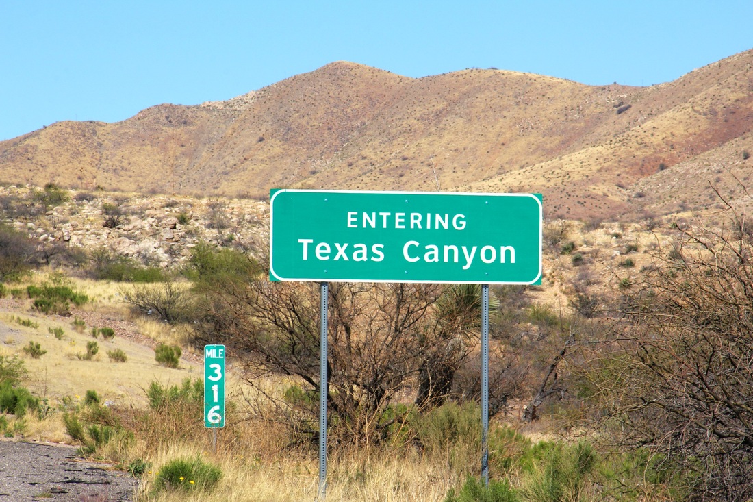
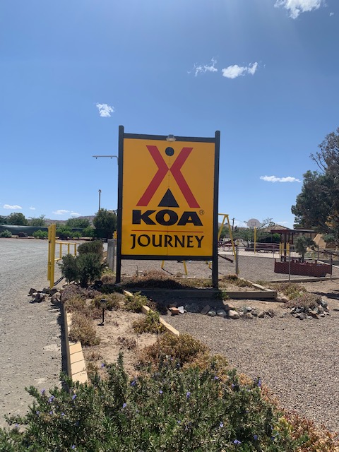
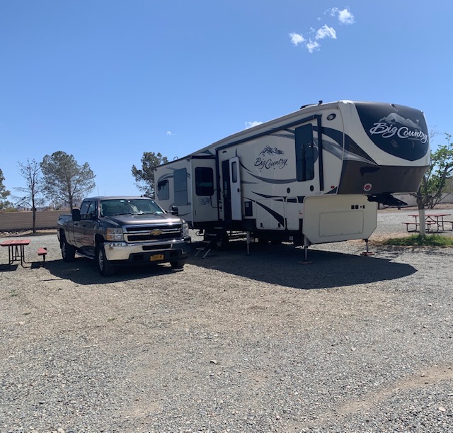
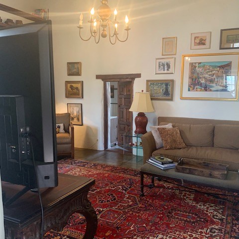
We were rockin down Highway 10 to Lordsburg, New Mexico. Our first travel day in 9 months! We rode 147 miles takin it easy on our first day of travel.
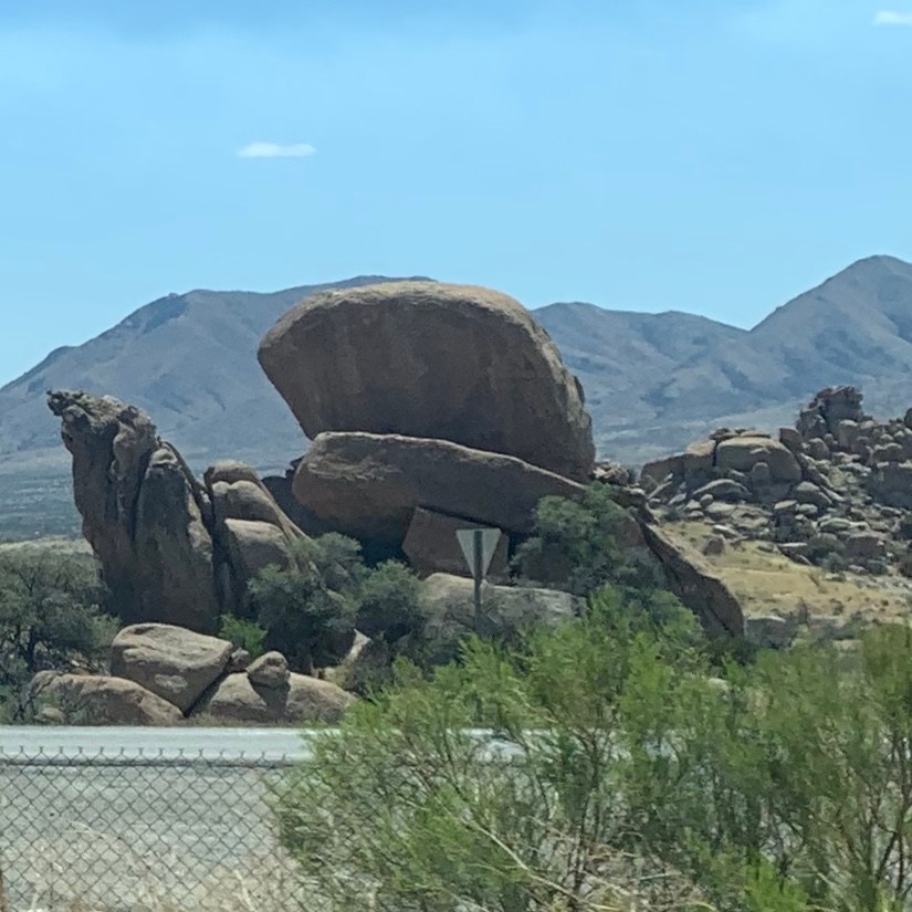
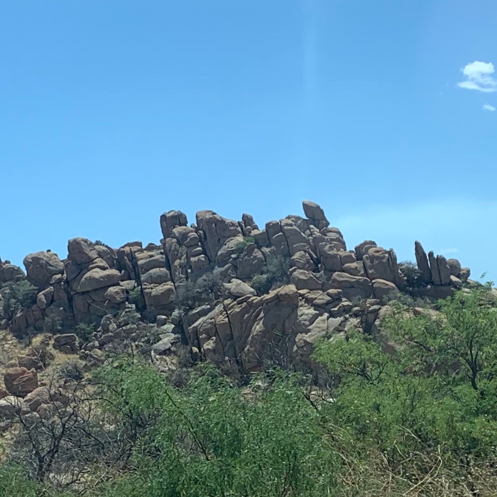
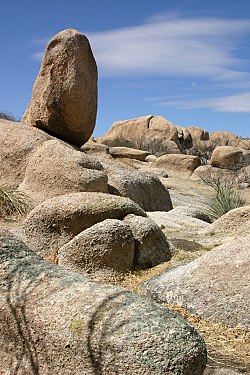
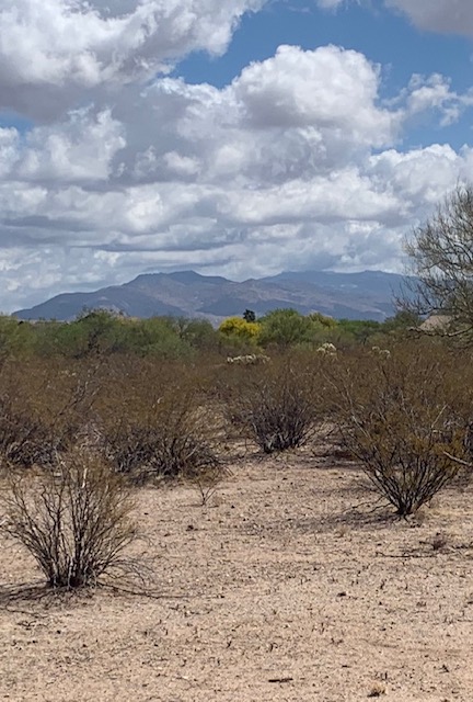
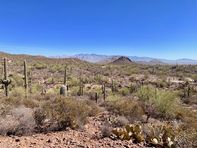
Traveling from Tucson to Lordsburg on route 10, halfway between Tucson and the New Mexican border, we passed through “The Texas Canyon.”
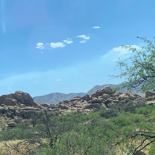
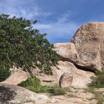
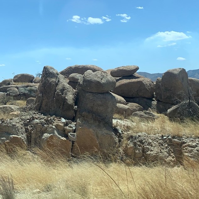
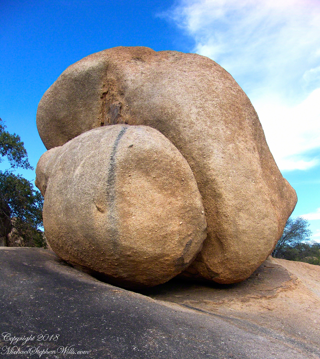
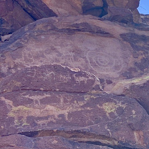
As we’re driving by I thought these rocks are so cool I need to take pictures, I’m glad I did. The rocks are what makes this canyon so unique. The rock formations are made up primarily of granite and metamorphic rock. The area has a long and complex geologic history, with rocks that range in age from approximately 1.4 billion years old to just a few million years old.
One of the most striking features of Texas Canyon is the dramatic cliffs and towering spires that rise up from the desert floor and boulders that balance on top of each other.
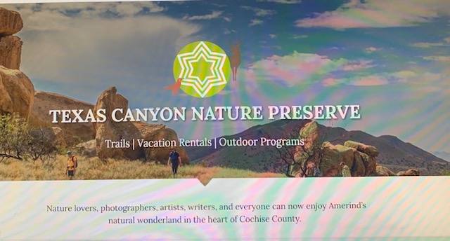
The Texas Canyon is a Nature Preserve with a museum and lots of great trails that take you up close and personal to the rocks.
Checked the website and saw these rocks. I know I want to go here when we’re headed back this way. You never know what your gonna see.
We arrived safe and sound at the KOA site #8 in Lordsburg, NM. Have a goodnight everyone.
“Here’s to hoping you thrive in April just as jokesters, tax collectors and the Easter Bunny do.”
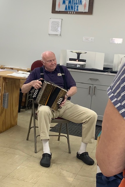
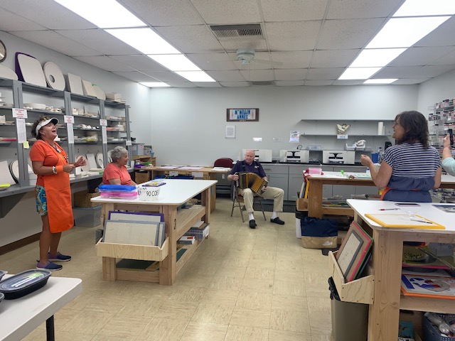
We were singing and dancing to “Roll Out the Barrell” at glass fusion by Henry, Supervisor Cathy’s husband. It’s always a fun place to be.
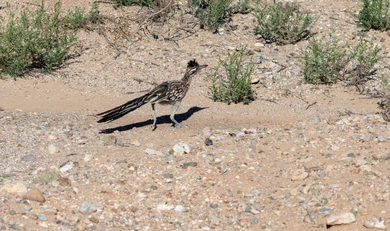
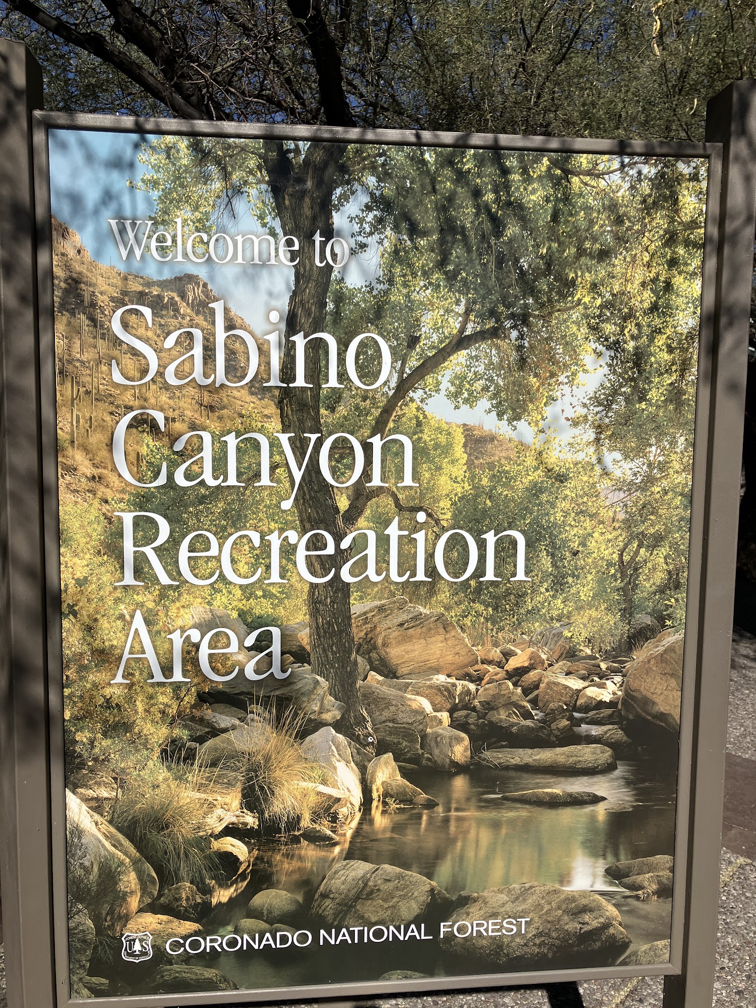
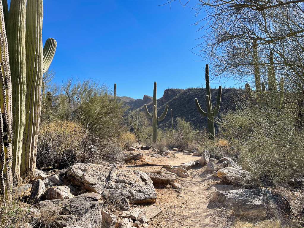
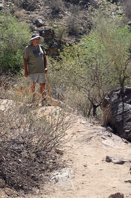
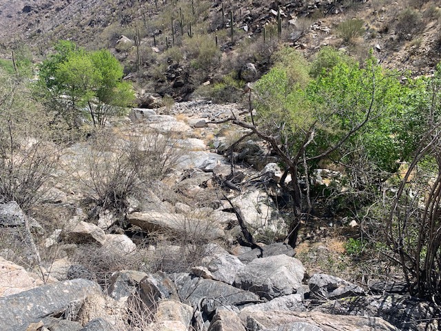
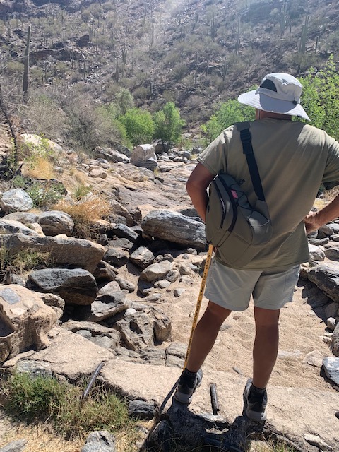
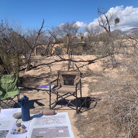
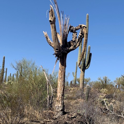
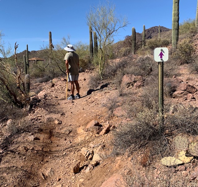
On Sunday April 6th we visited Sabino Canyon once again, and came across a Roadrunner.
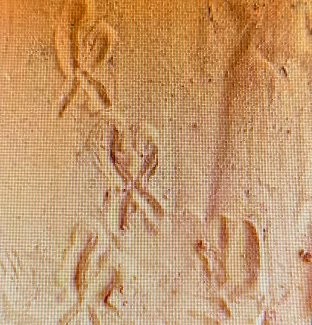
It’s always neat to see a Roadrunner, you can take a picture when their still but when they take off, they quickly are gone. Roadrunners hold a special place in Native American and Mexican legends and belief systems. The birds were revered for their courage, strength, speed, and endurance. The roadrunner’s distinctive X-shaped footprint—with two toes pointing forward and two backward—are used as sacred symbols by Pueblo tribes to ward off evil. The X shape disguises the direction the bird is heading, and is thought to prevent evil spirits from following.
The Life of a Roadrunner . . .Past prickly cacti and golden blooms, Through tangled brush where freedom looms, They navigate with purpose clear, With every step, they draw us near. Their journey speaks to the heart’s desire, A flame of spirit, a light of fire, Chasing dreams beneath the sun, In every moment, life’s begun.
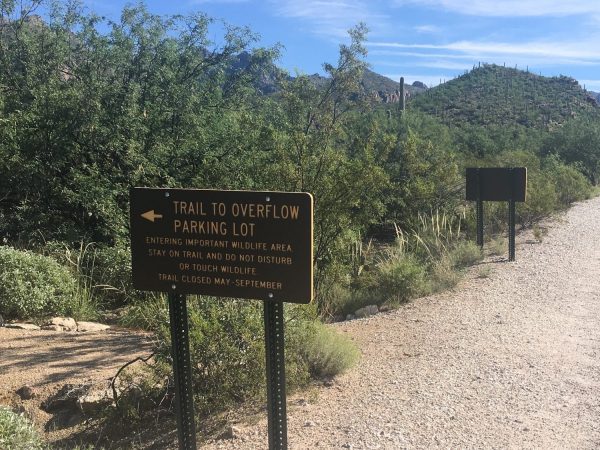
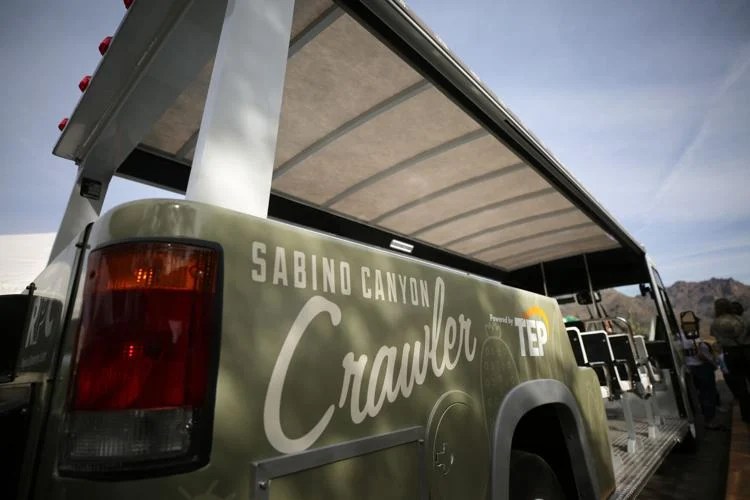
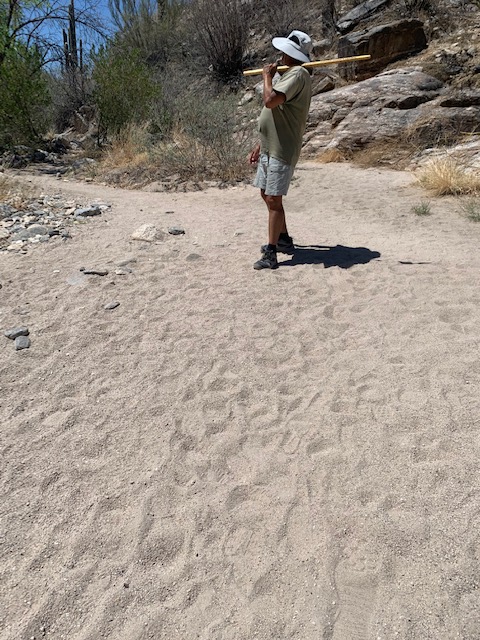
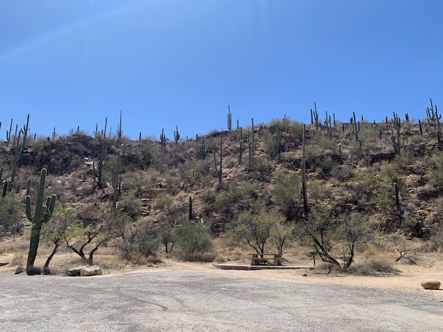
The weather was perfect Sunday morning for a hike in the canyon. But. . . When we arrived the main parking lot was full, it’s never been full, so we parked in the Overflow parking lot. Not to much of a problem only a little less than a mile to our destination the Visitor Center to get the Crawler to Bear Canyon.
On our way to stop 3 The Bear Canyon Trail, Our driver Chris, was telling us about his recent encounter with a lady who was so dehydrated she was fighting with the rangers because she had no idea of who she was or where she was. She and many other people aren’t prepared to hike, you need lots of water to keep you hydrated. He also told us of other experiences he had at the canyon. People who didn’t stay on the trail got lost, the park closed and it’s dark. Some folks are found by the rangers and some have spent the night. The rangers find them not in good shape and feeling very disheartened. The moral of the story is the Girl Scout Motto – “Be Prepared”
Sabino Canyon is known for flash flooding too. Several people have died or have been stranded in Sabino Canyon from flash flooding over the years. In recent years someone died jumping in to the falls and a helicopter came to retrieve the body, a bunch of onlookers were swept away because the wall of water came down so fast they could not get out of the way. Another time two deaths occurred due to flash flooding when a wall of water cascaded over a waterfall. In 1985 the canyon had a terrible flash flood that resulted in significant damage and loss of seven lives and 50 people were injured during the event. The moral of this story is, “Stay alert for signs of heavy rain and Get to the higher ground If flooding occurs”.
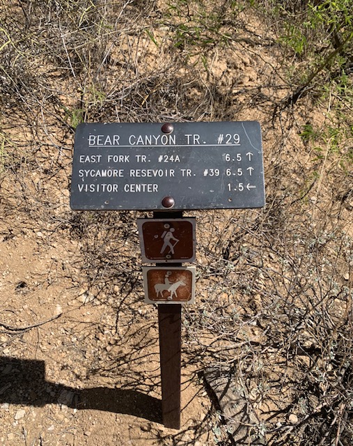
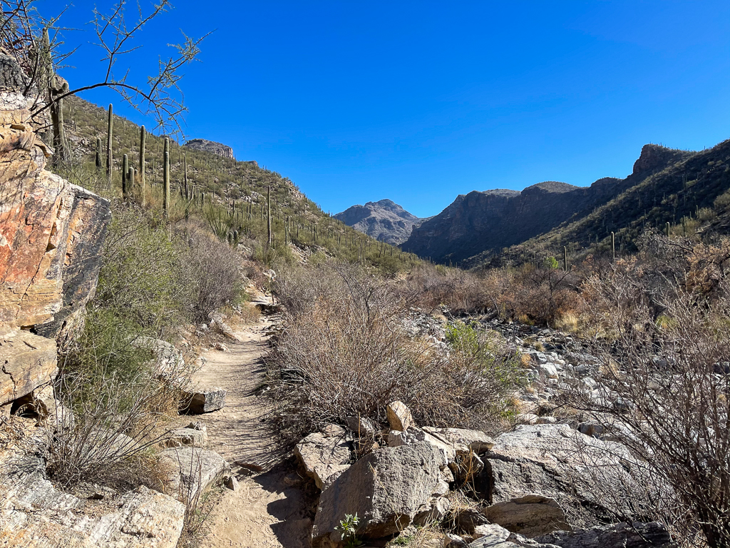
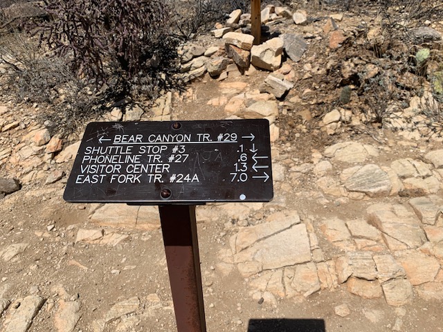
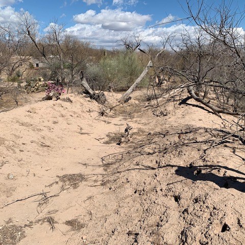
We got off at stop 3 at the bottom of the map at the red crawler shuttle, and started hiking The Bear Canyon Trail. It’s a scenic trail that has a moderate-difficulty hiking trail that follows the canyon floor, eventually leading to Seven Falls. The trail crosses Sabino Creek seven times times, and has beautiful views of both Sabino and Bear canyons. We figured the hike we would about a 4 miles or maybe 5 mile hike at the most.
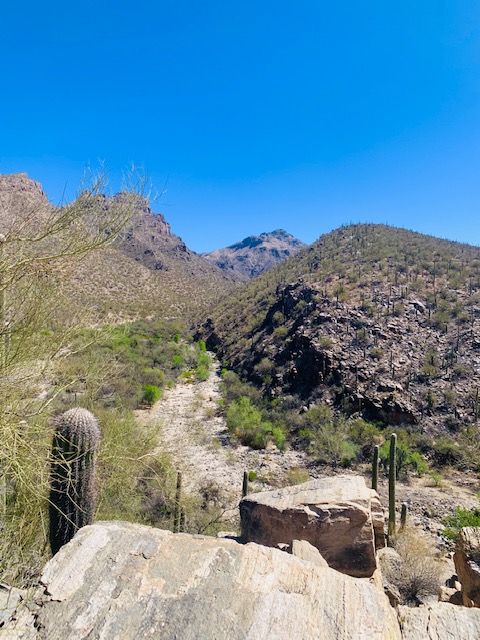
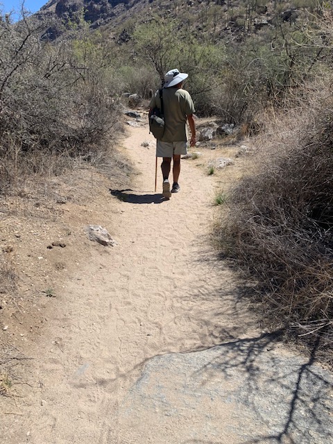
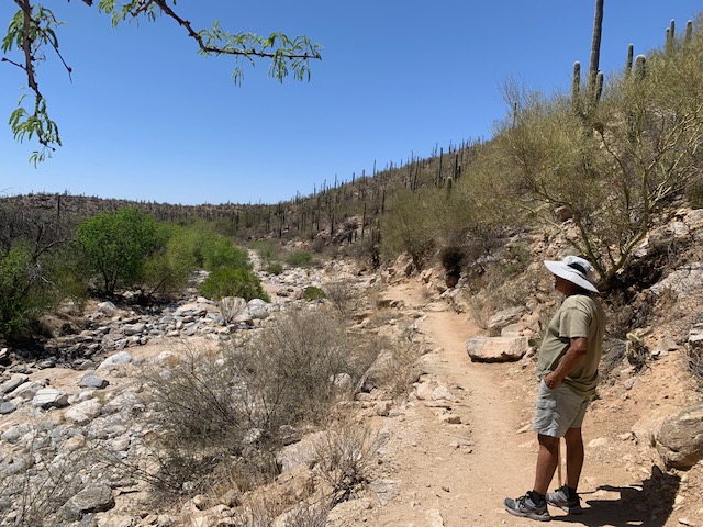
The Bear Canyon trail takes you through a multitude of creek crossings, taking you up through and down through the rocks, in between the rocks and sandy areas. It’s a very scenic trail that keeps you a hopin.
We stopped just before the Seven Falls Trail starts, we decided not to go further because we weren’t prepared and there most likely wasn’t any water in the falls ahead. We’ve gone about 3 miles so we headed back the same way then we took the the trail to the dam.
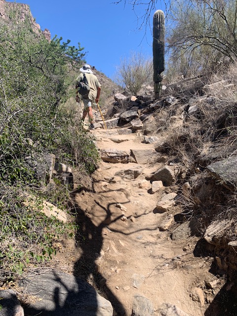
We also learned that people are rescued in the canyon all the time by the Pima County Sheriff’s Department, the Arizona Dept. of Public Safety and mostly by the Southern Arizona Rescue Association (SARA). SARA it is a non-profit volunteer organization that provides free search and rescue services. The organization has been serving southern Arizona and Pima County since 1958. These people are truly dedicated, they don’t get paid and give up a lot of their time.
They have specific qualifications that need to be met. They do their training climbing up on the Blackett’s Ridge Trail in Sabino Canyon with live saving equipment on their backs. The trail is considered one of the most difficult hikes in Tucson It’s known for its narrow ridge and steep climbs, requiring experienced hikers. It has an elevation of 4409 feet. The trail starts at 2,725 feet and gains approximately 1,765 feet of elevation.
You gotta be in good shape to climb this!
On 4-15-25, the SARA was requested by the Pima County Sheriff’s Department to assist in the extrication of a person that had stumbled on trail and injured themselves. The injury did not allow them to walk out and required a stokes out. Just a normal day for them, they truly need them here.
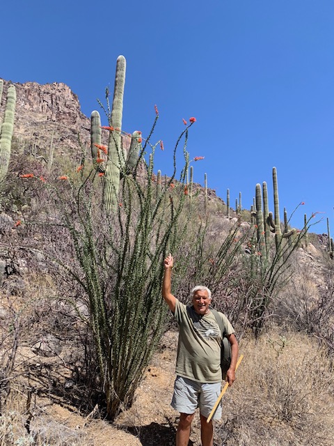
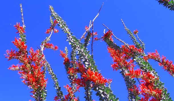
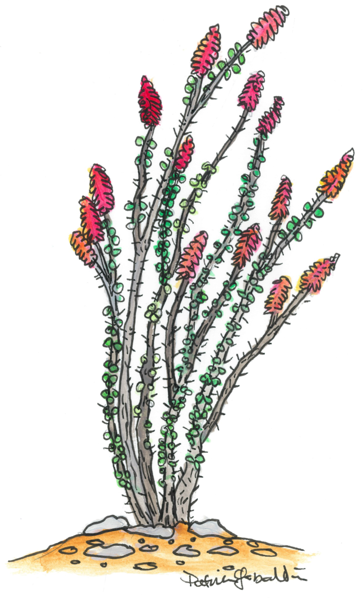
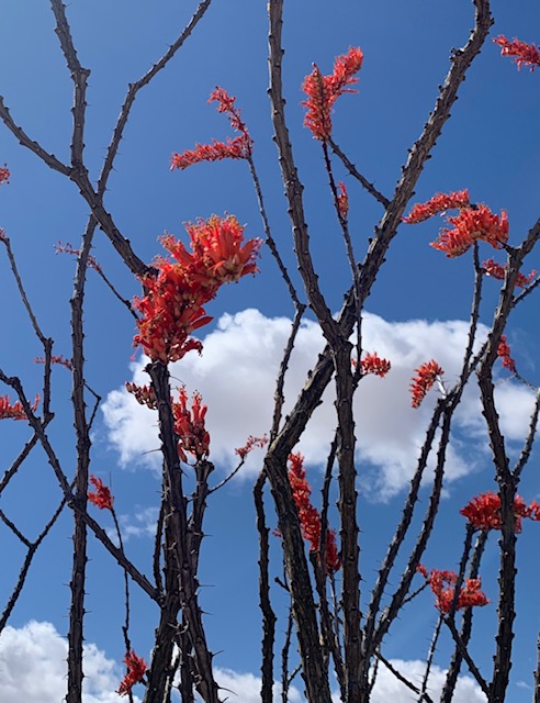
Dave’s favorite Cactus is the Ocitillo
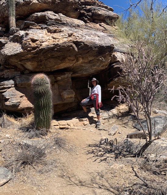
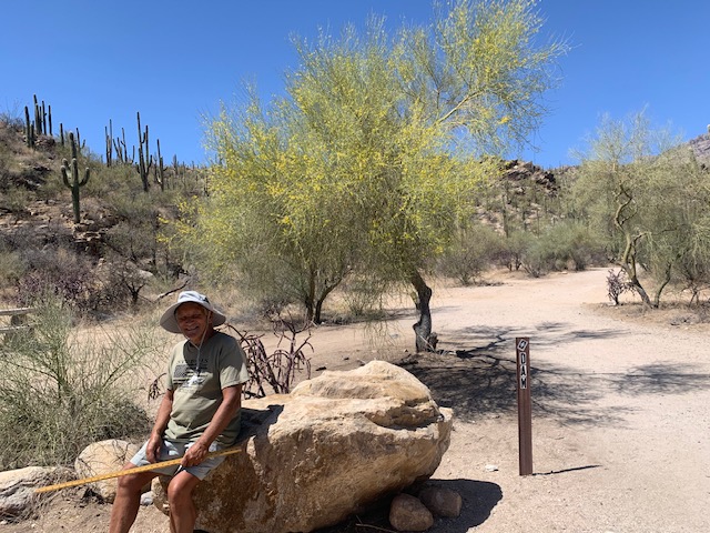
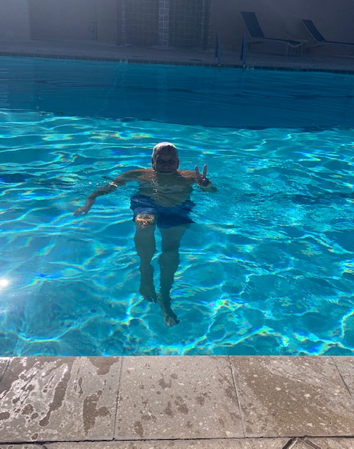
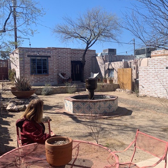
It’s me and yes I have water.
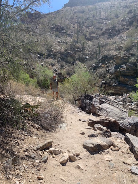
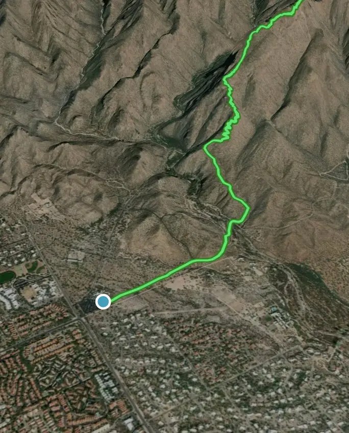
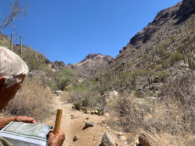
Dave is checking the map to pin point our location.
Dave is trying to hitch a ride.. . 🎵Ride, Ride, Ride, Hitchin a Ride 🎶
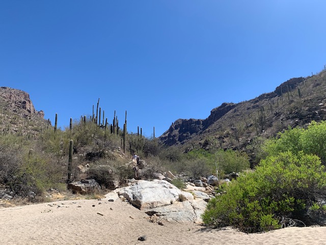
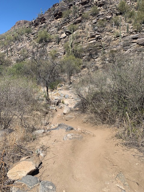
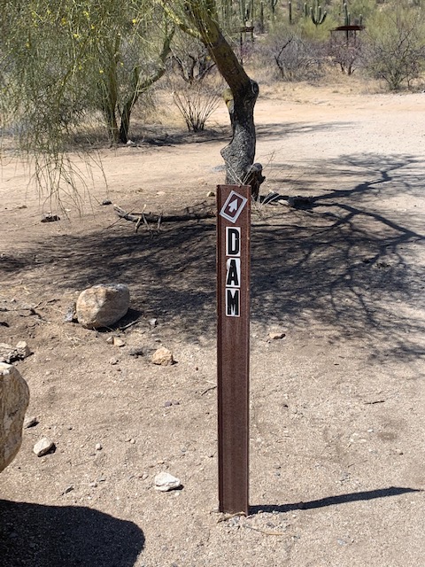
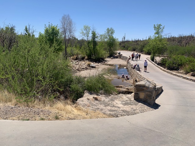
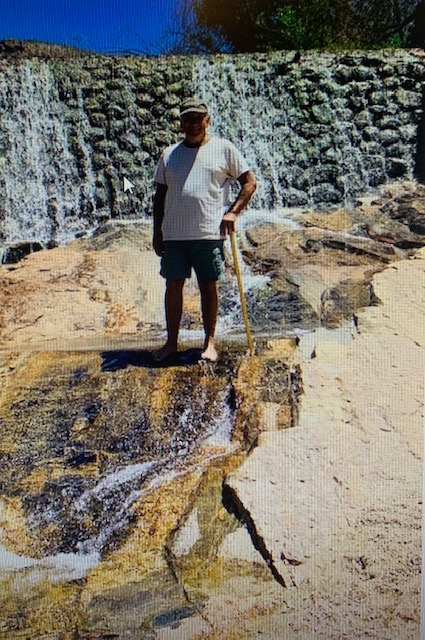
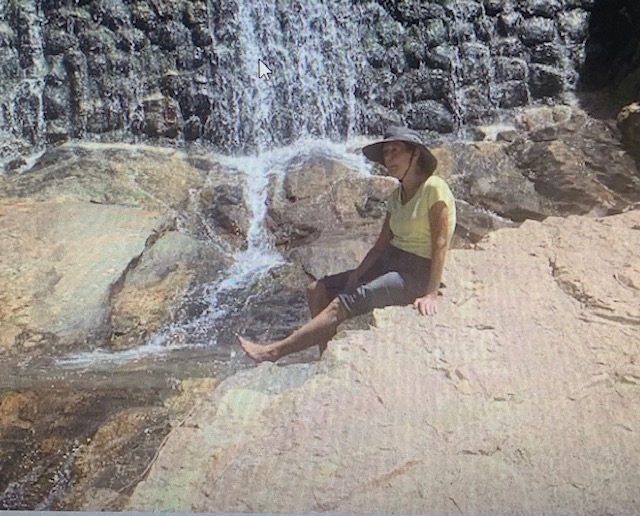
Took the Dam Trail to the water.
We were surprised to see the dam so dry this year.
When we were there last year in May the dam was flowing.
We took the Dam Trail to stop #3 where the crawler picks you up. We were a couple of minutes late so we figured we’d walk back to truck in the over flow parking lot. Dave said we must have walked a little over 5 miles. I was laughing cause we already walked a little past 6 miles. We started walking and when we were part way there here comes the Crawler passing us, It Was Late! So we figured we might as well walk the whole way back a total of 7.5 miles! We were definitely feelin the hike but we we’re laughing cause were Not to Shabby for a Couple of Old Codgers.
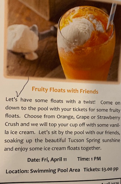
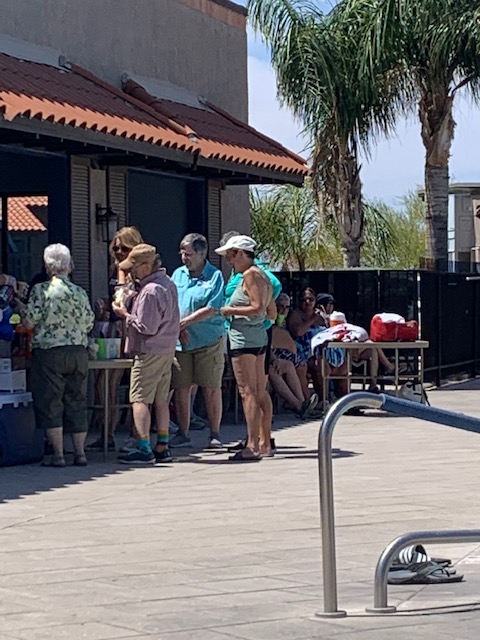
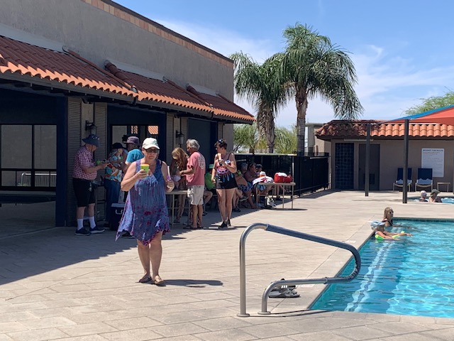
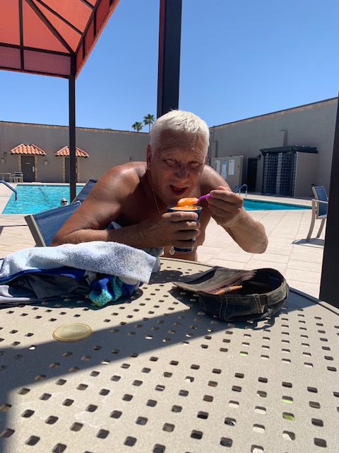
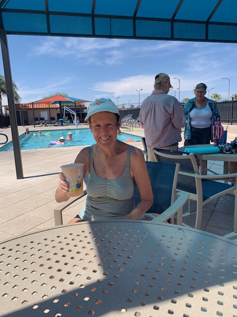
On Friday April 11th Voyager had a “Fruity Floats with Friends.” An ice cream party at the pool.
It was a warm day so it was perfect for ice cream at the pool. It just doesn’t get any better.
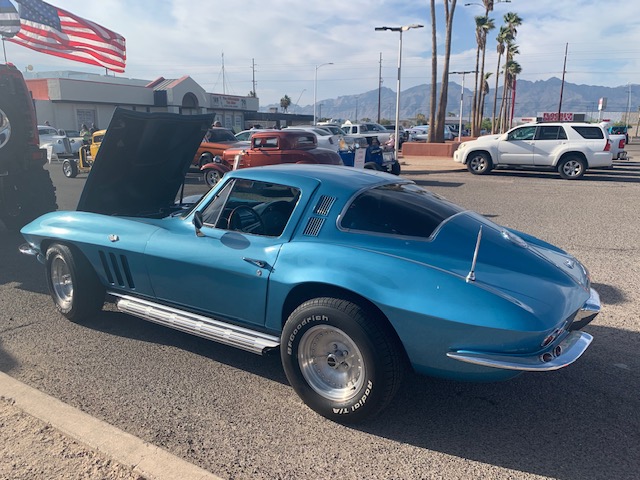
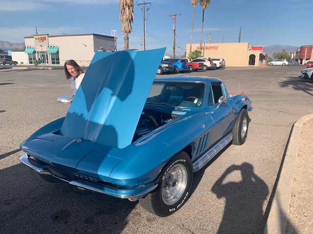
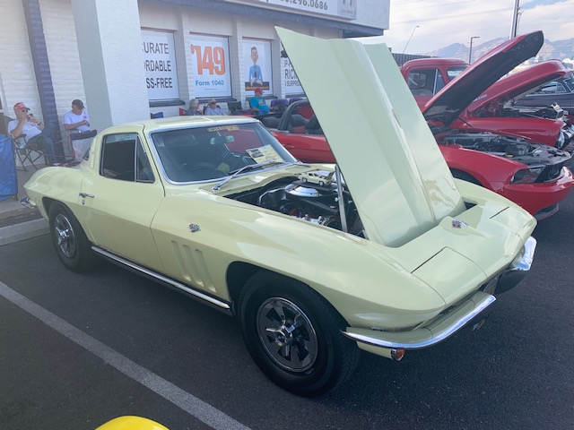
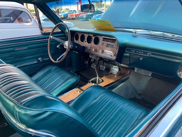
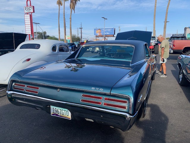
On Saturday April 12th we went to a Car Show at Little Anthony’s Diner.
It’s always fun to go to a car show at Little Anthony’s. They didn’t have a huge selection this time, but you can always find one that you could picture yourself driving down the road in.
Another reason is to go to Little Anthony’s Diner besides the car show is their delicious food! Especially a delicious Turkey Dinner with all the trimmings, even cranberries. They even ask if you want white meat, dark meat or mixed. Plus the atmosphere is always fun. If your ever in the Tucson area give them a try.
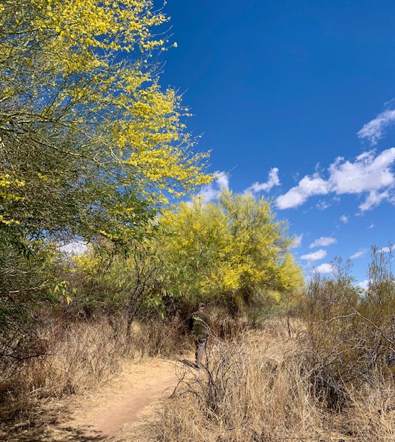
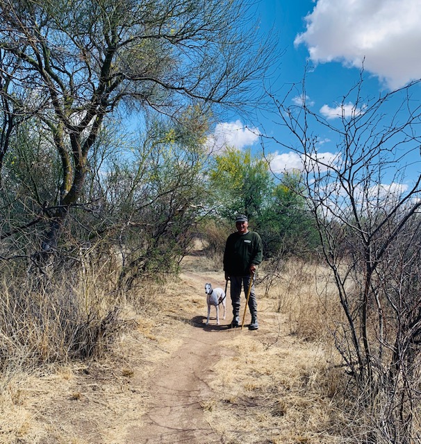
Saturday was the perfect morning for a walk in the desert across from Voyager
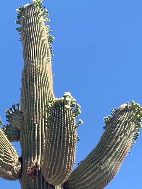
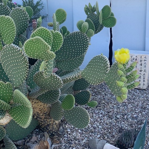
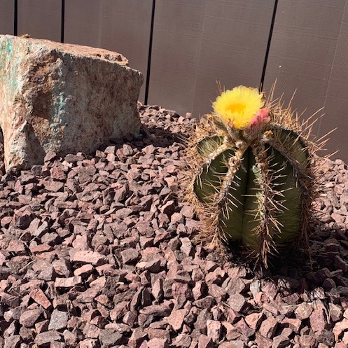
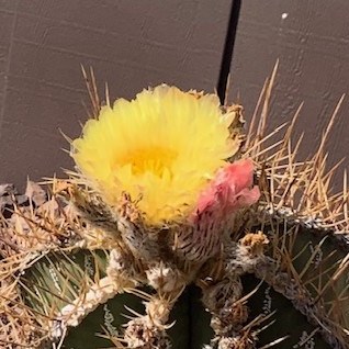
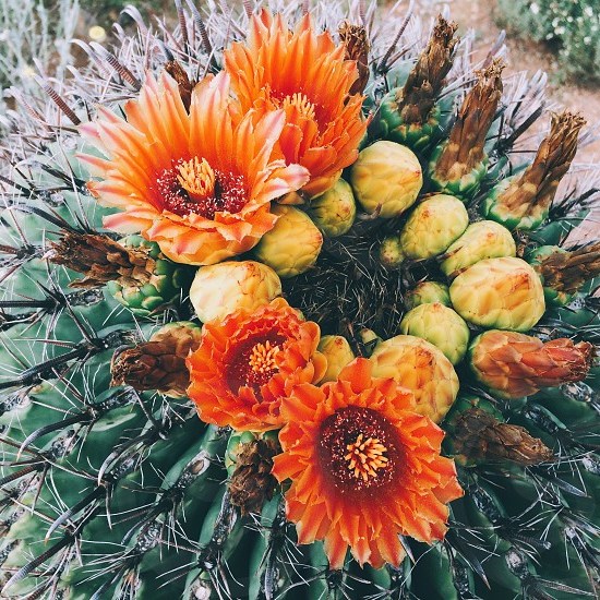
You can see the green in the desert and some of the cacti are starting to bloom.
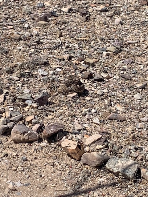
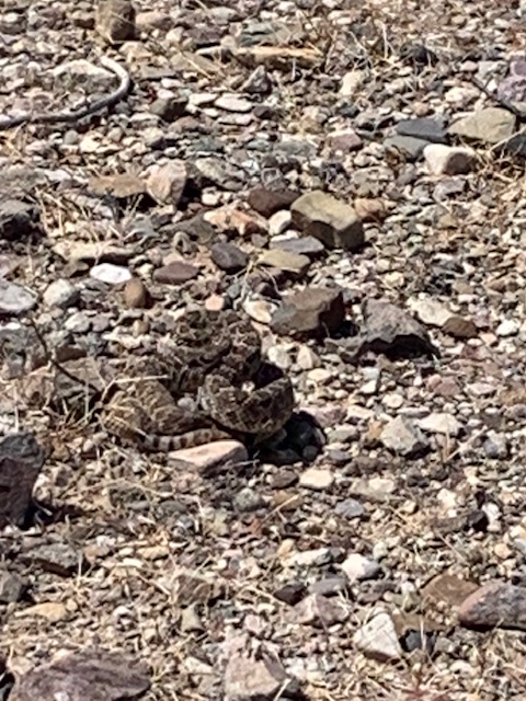
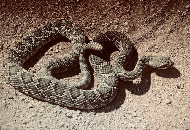
Dave came upon this snake, when it saw him it was ready to strike. We went around it but I managed to get a picture. Our first encounter with a rattler! Good eye Dave!!
It’s Sunday April 20th
Hope Everyone had a great Easter
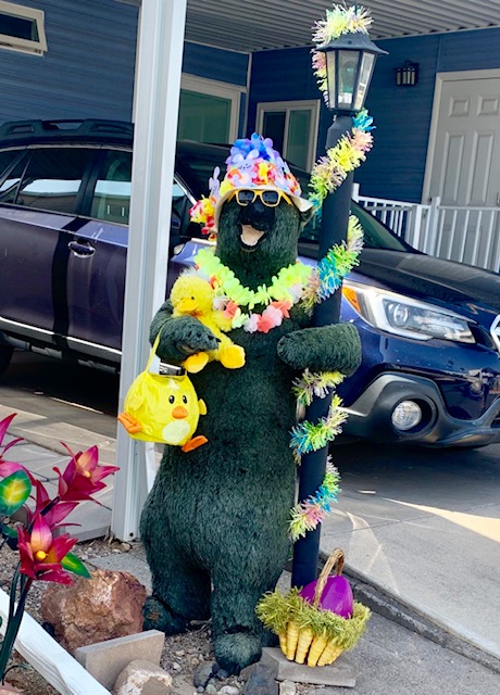
The Easter Bear here at Voyager
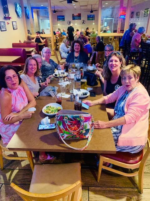
Friday April 25th was my last Happy Hour at Fat Willy’s for awhile. Myself and some of my wonderful friends celebrated. Fun as Always!
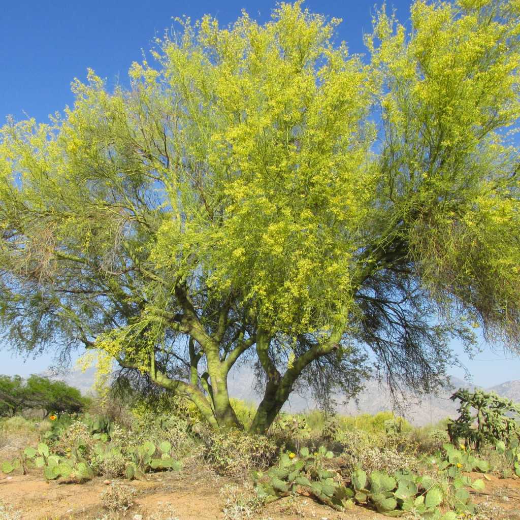
A mesquite, that strange desert tree that gives shade, shelter, firewood, flour, sugar and horse-feed… ~George Wharton James, Arizona, the Wonderland, 1917
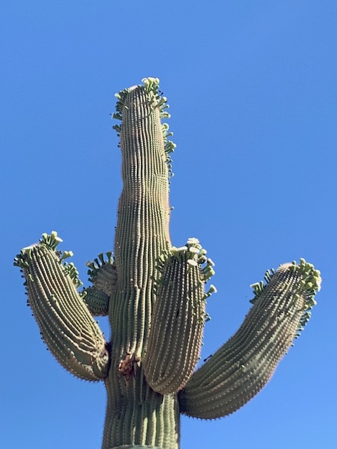
The saguaro, or giant cactus, is one of nature’s rare and curious productions. It has appropriately been named “The Sentinel of the Desert.” Its fruit is delicious and has the flavor of fig and strawberry combined. When the tree dies its pulp dries up and blows away and there remains standing only a spectral figure composed of white slats and fiber that looks ghostly in the distance. ~Joseph A. Munk, “Some Desert Plants,” Arizona Sketches, 1905
a shrug, a hug touchdown, letdown waving, curling, sprouting disco, vogue; praise, prayer bird-pecked, green-specked skeletonized, or multiplied flower and fruity fingered flipped, frail, or fallen off perfected, nested, crested ~Terri Guillemets, “Saguaro arms,” 2020
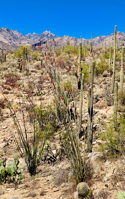
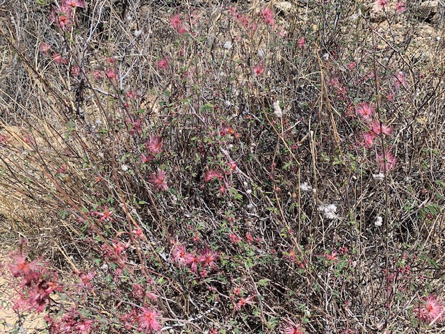
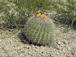
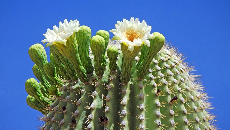
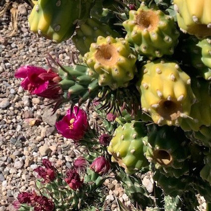
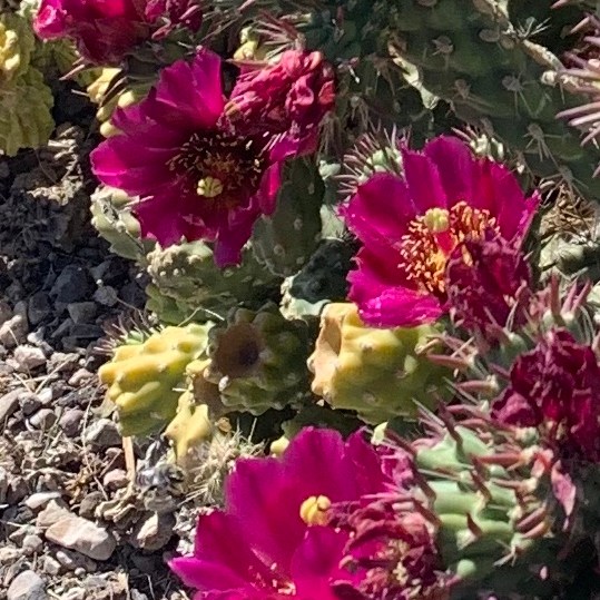
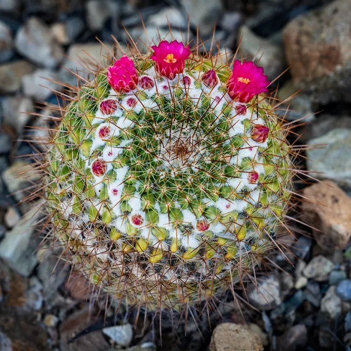
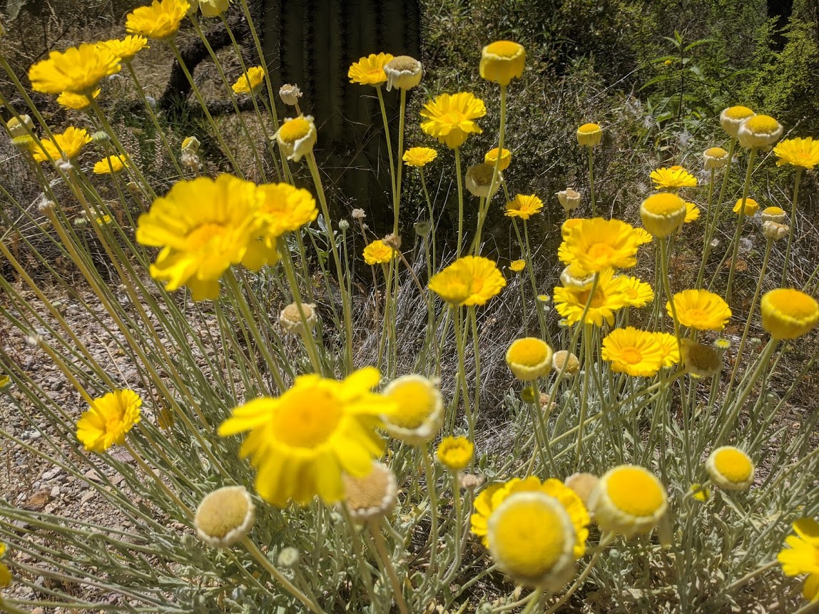
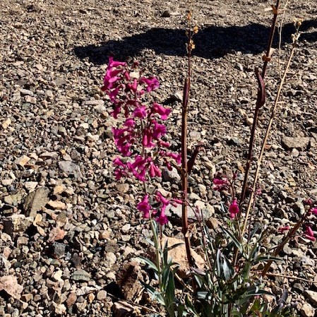
The Cactus were starting to show off their beautiful colorful flowers!
Tomorrow April 29th, We’re heading back East and leaving the West behind us for a bit.
“I had a pard who came from Arizona. All day long and half the night that broncho buster would rave about Arizona. Well, he won me over. Arizona must be wonderful.” “But Pan, isn’t it desert country?” “Arizona is every kind of country…“ ~Zane Grey, Valley of Wild Horses, 1947
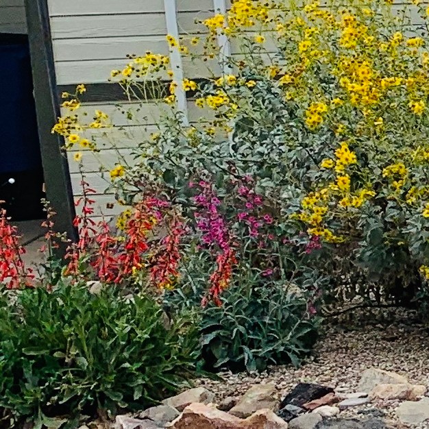
Spring in Arizona is from March to May. It makes it nice to walk around the park and see the flowers in people’s yards.
“Some old-fashioned things like Spring flowers, fresh air and sunshine are hard to beat” – Laura Wilder
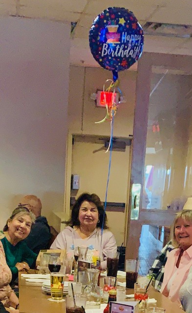
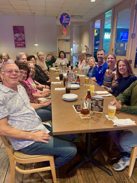
On March 3rd a group of us got together to celebrate our friend Bert’s Birthday.
We celebrated at Fat Willy’s the restaurant here at Voyager. It was Burger Monday so we got a burger, fries and birthday cake. yummy.
“You make the world a brighter place just by being in it—Happy Birthday!
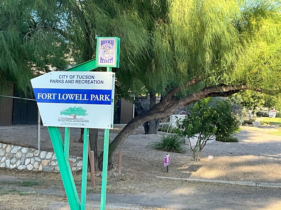
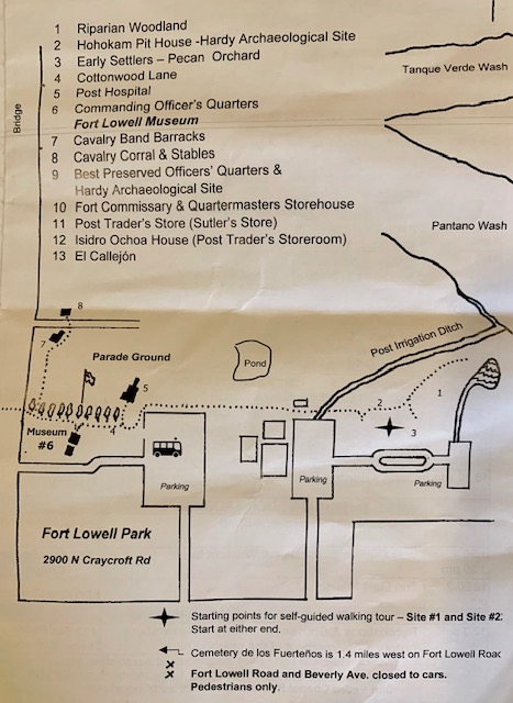
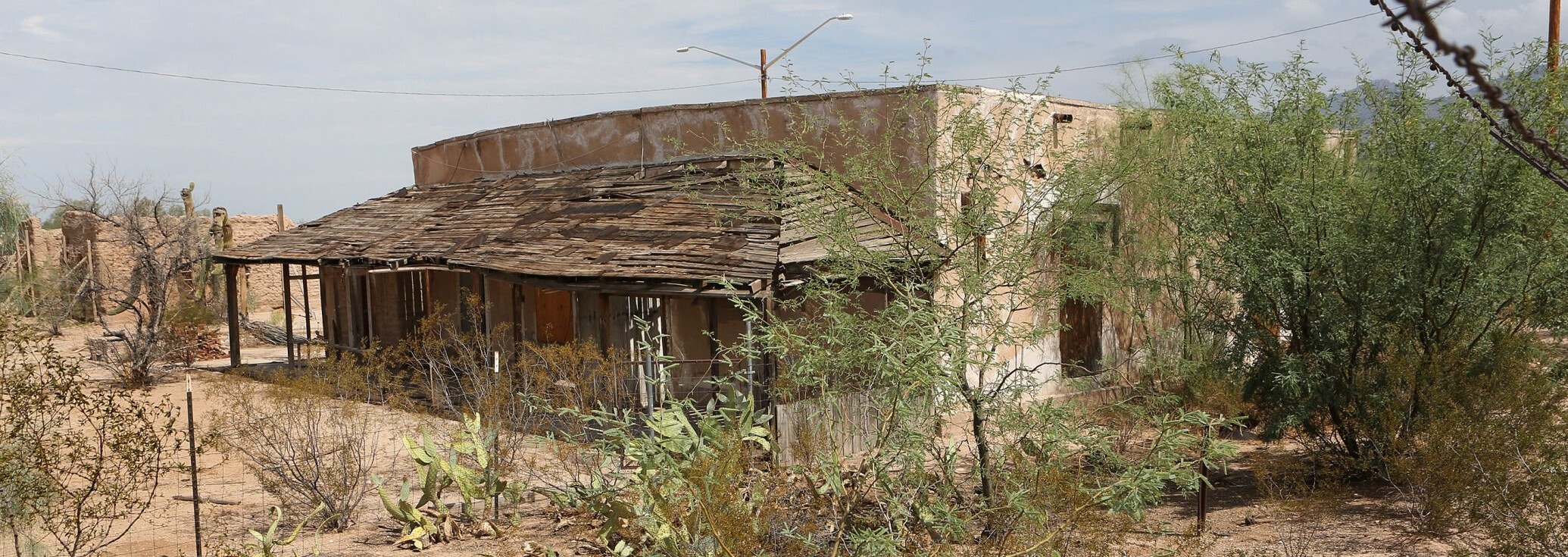
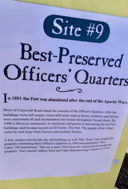
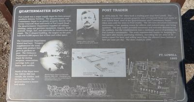
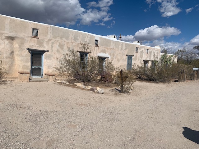
Fort Lowell Park is a 59-acre park, located near Glenn and Craycroft Road. The park is home to a swimming pool, pond, history museum, one-mile walking path, pecan grove, sports fields, tennis courts, two playgrounds, and a sand volleyball court.
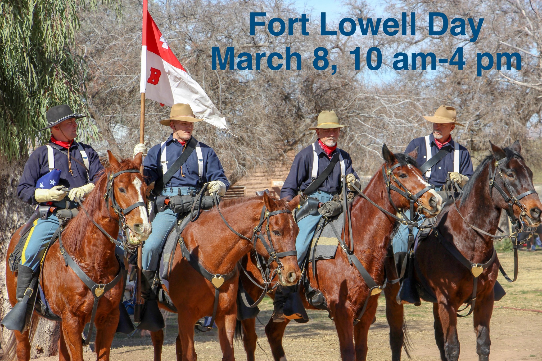
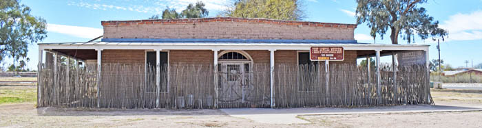
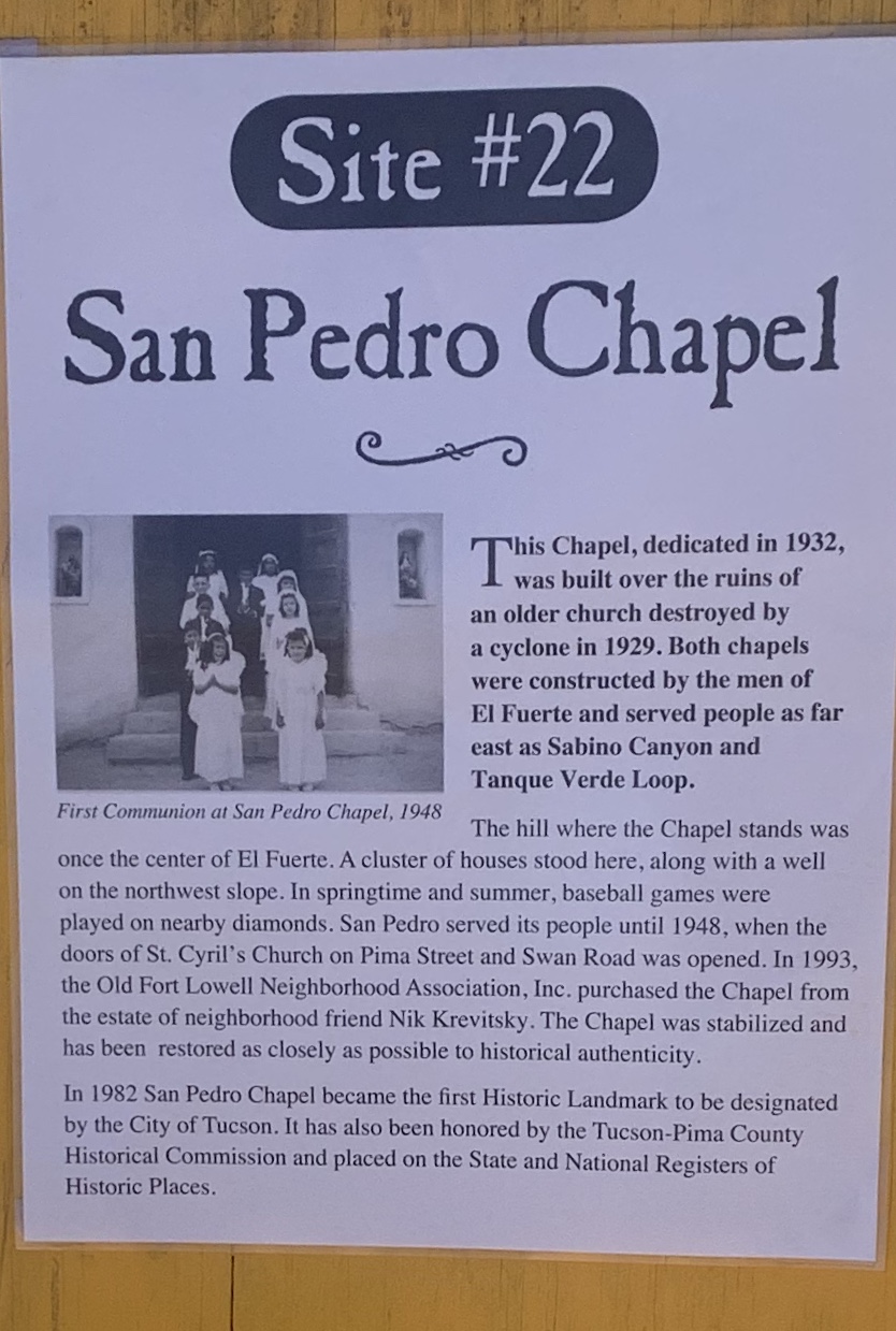
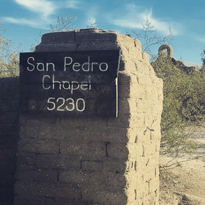
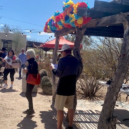
On Saturday March 8th we went to the Fort Lowell Museum located in the park to the “Fort Lowell Day Celebration of History of the Fort and neighborhood.” It included a self-guided walking tour along Fort Lowell Road, and at the historic San Pedro Chapel, 5230 E. Fort Lowell Rd. Tucson.
Fort Lowell was a military supply post that is now run by the Oresidio museum that we went to see in February. Visitors can see the buildings and also the ruins of buildings in the fort which are being protected and rebuilt. You can explore Army life during the Apache wars and see displays about the purpose and history of the fort, its soldiers, and their families, Displays are also included about the Apache of the region and the pre-history of the area.
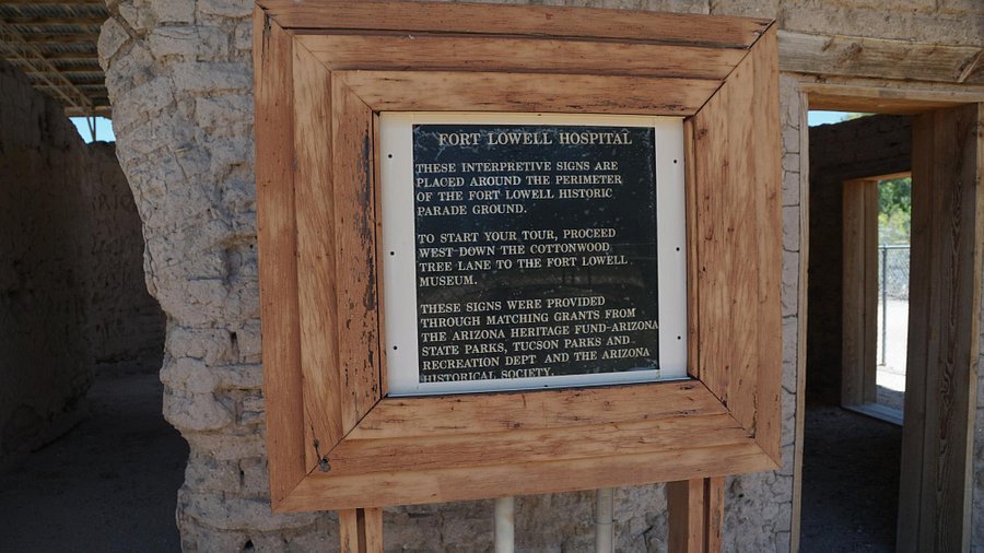
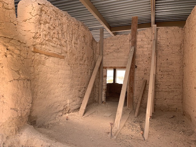
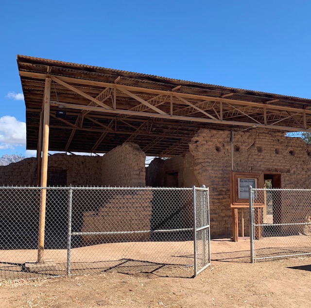
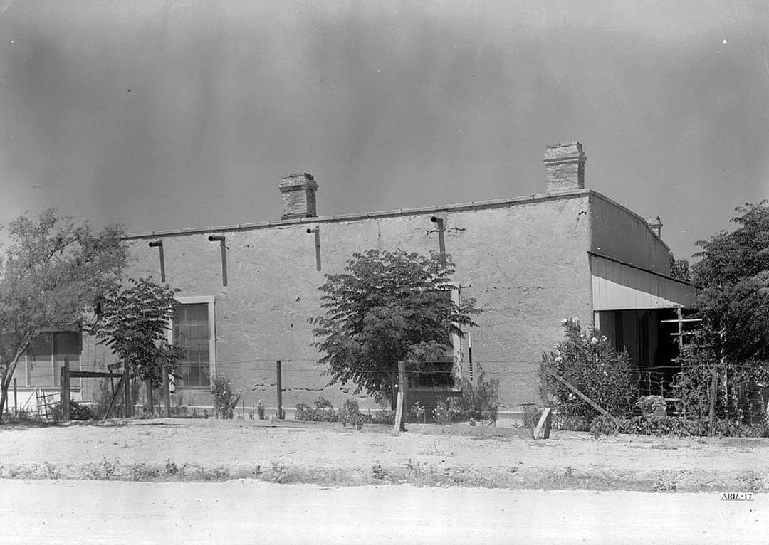
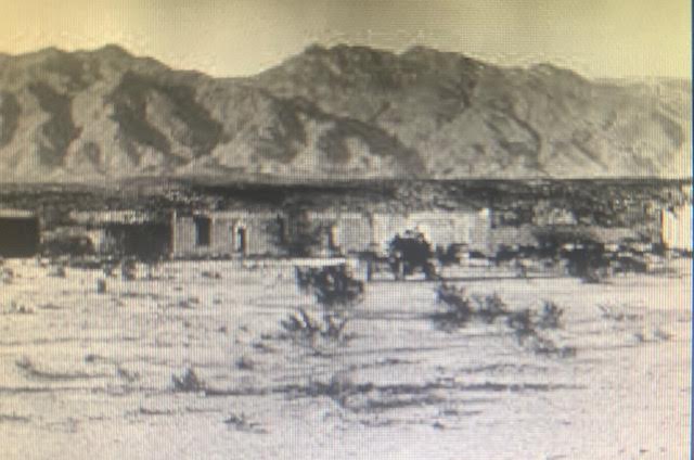
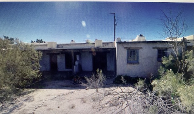
hospital – before
Ruins of the hospital that they are reconstructing.
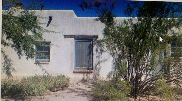
Commanding officer’s house Before – Museum Now
The Army moved the fort here because it was a pretty consistent source of water and it was good spot for farming. Another good reason the fort was built here in 1873 was because the Army had worn out its welcome in downtown Tucson. Some rowdy soldiers who frequently got drunk and assaulted civilians were farther away but still available to protect the area and spend money. “The Army said ‘Hey let’s get them ’em out of here, let’s put ’em somewhere else.'” The soldiers packed up their tents and equipment and moved seven miles outside of Tucson, establishing a new location for Camp Lowell. The camp was renamed Fort Lowell in 1879. At its peak, Fort Lowell comprised approximately 30 adobe buildings, including a hospital, commissary, trading store, guard house, officers’ quarters, and kitchens. Hundreds of cavalry and infantry protected the area from Apache raiders until Fort Lowell was no longer needed by the Army and was abandoned in 1891.
Settlers moved in and used some fort buildings as residences, or stripped the buildings of useful materials. By the 1930s, much of the fort had fallen into disrepair or had been sold off. After World War II, this area became known as “El Fuerte” – “The strong.” Mexican families from Sonora soon moved north to take advantage of the “free” repurposed fort housing and framing jobs. In the early 20th century the small village continued to grow west of the ruins of the old fort. Many examples of their Sonoran-style adobe homes can be seen here today. Also visible is an irrigation system built by Mormons in the 1890s for carrying water from the Tanque Verde Creek to their farmlands nearby.
The Tucson Boy Scouts began camping near the ruins of Fort Lowell in April 1912, just a year after the Boy Scouts of Tucson were established. In 1945, with the assistance of Carlos Ronstadt (an uncle to Linda Ronstadt), local Boy Scout troops obtained 40 acres of the fort grounds to prevent developers from destroying what remained. According to historian David Leighton’s research, the scouts were actually the first to preserve some of the adobe ruins. They constructed a metal roof over the ruins of the Fort Lowell Hospital. Eventually the property was donated to Pima County when the scouts could no longer afford the maintenance costs. I’m thinking camping at the fort was a really neat thing to do.
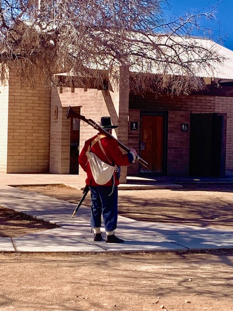
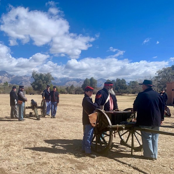
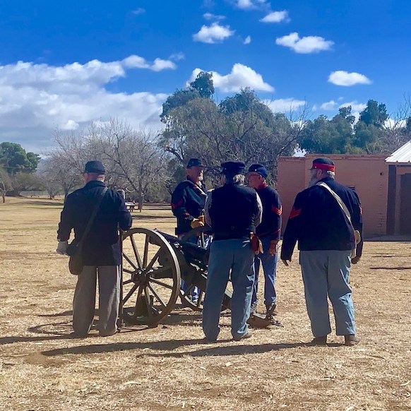
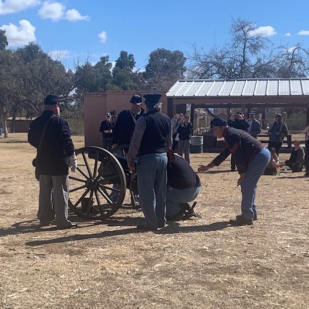
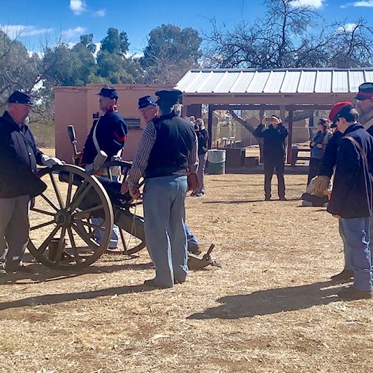
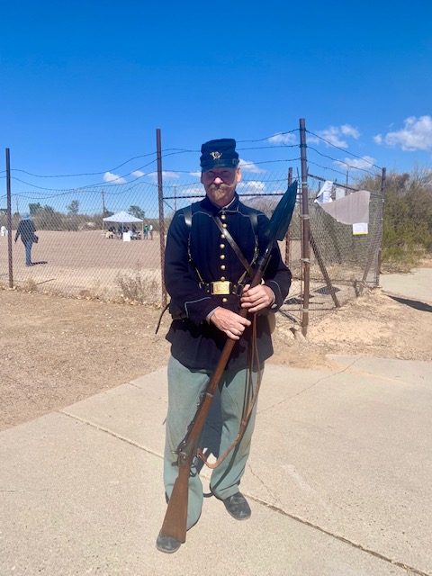
Ready, Aim, Fire 🔥
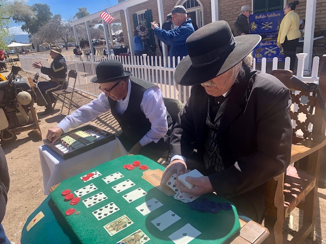
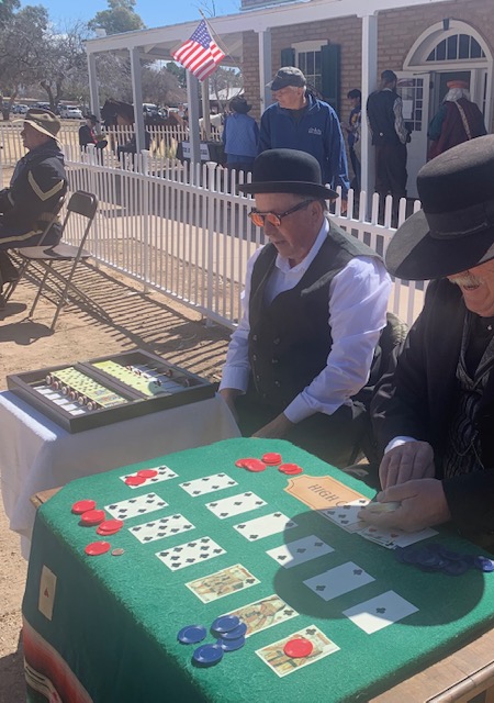
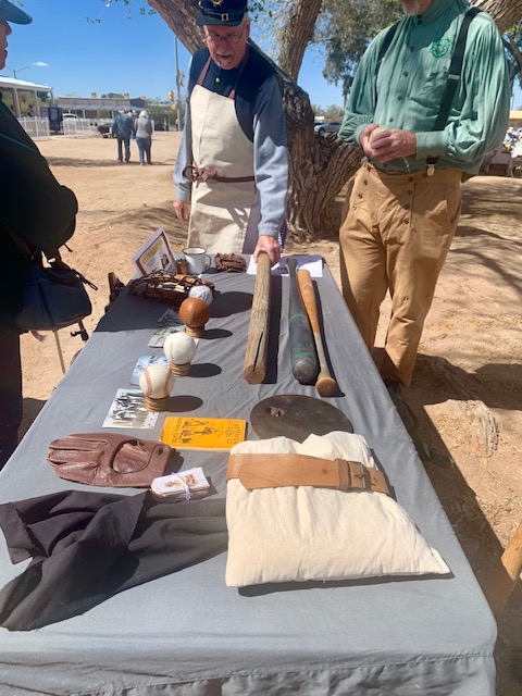
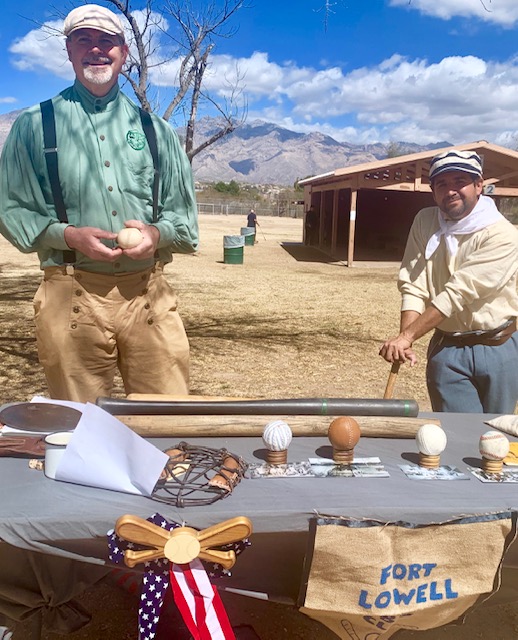
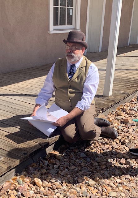
Playing games they did back then.
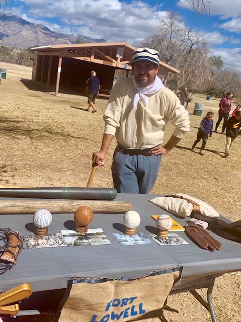
Fort Lowell had a baseball team. On the table they had home made balls, bases and bats that were used back then. Batter, Batter – Swing
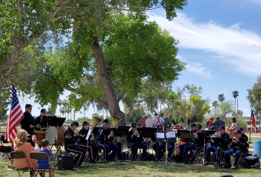
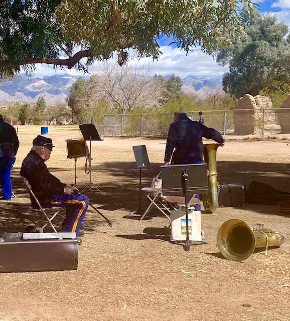
The 4th Cavalry Regimental Band of Fort Lowell
Volunteers were cooking food that the soldiers would have eatten back then.
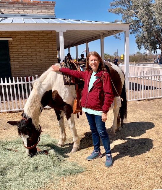
People came into the fort riding their horses with period clothes.
It was fun to be here in the fort with lots of events going on.
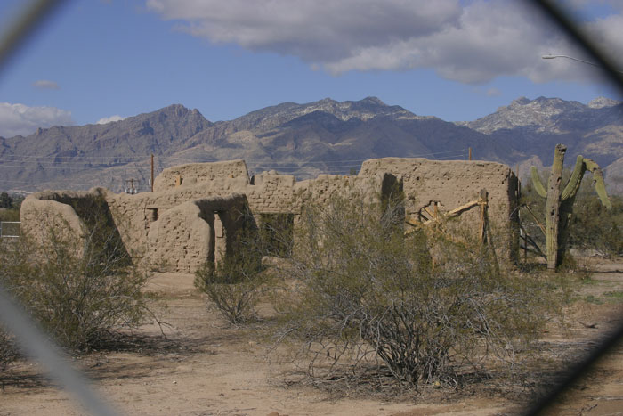
We went on a walk with archaeologist Homer Thiel. He took us across Craycroft Road to the other section of the park, which is closed unless special events are going on. There are also ruins on several sites on this side of the park, including three of the original seven officers’ quarters buildings.
Officer’s quarters
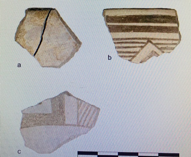
Homer Thiel spoke of another attraction to the fort, the Hohokam culture that existed here and in the Sonoran Desert from about AD 500 to 1450. The fort was a large Hohokam village that was here mainly because of the availability of a constant water source that made the area a great place to settle. Living in the desert it’s all about water. The Hohokam are well known for their beautiful painted pottery, elaborate projectile points, carved stone, shell items, ballcourts, and platform mounds.
Hohokam artifacts from the museum
But the living history of Fort Lowell also needs to be experienced by going outside the museum and into the surrounding neighborhood.
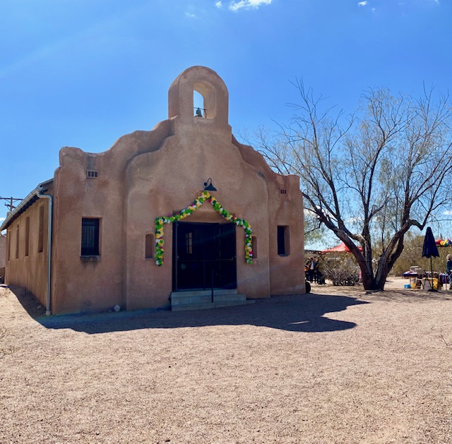
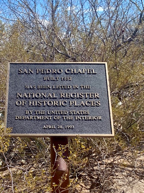
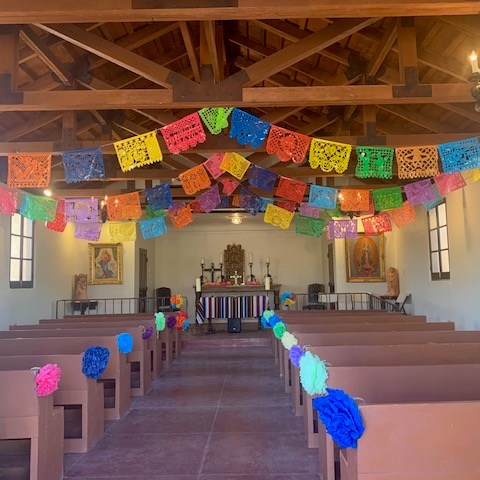
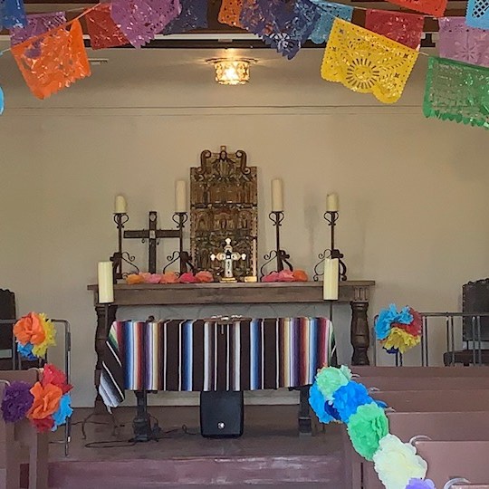
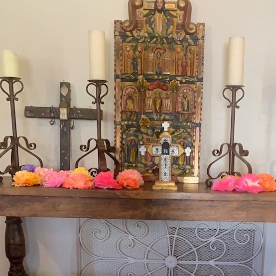
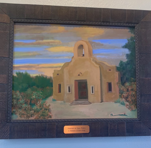
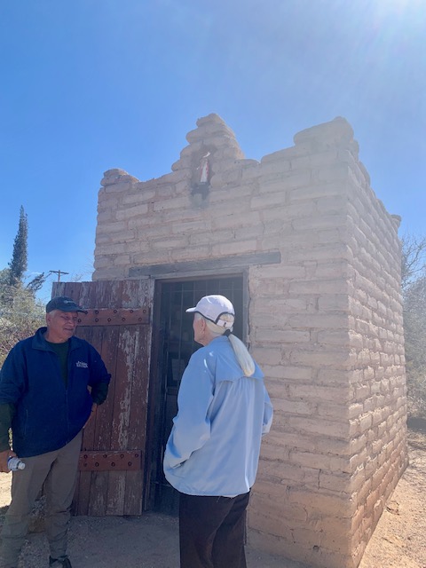
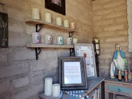
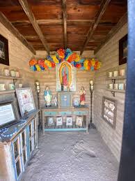
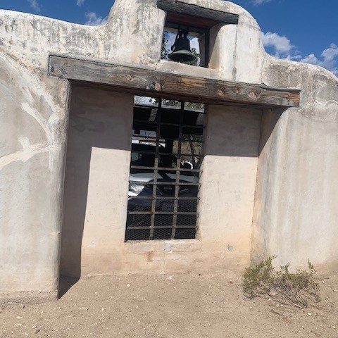
When the Fort was no longer, Mexican families moved into the area. They used materials from the fort’s buildings, they constructed a growing community and built the San Pedro Chapel. The Chapel sits on a hillside overlooking the Old Fort Lowell Neighborhood with spectacular views of Tucson’s Catalina Mountains. It was such as awe-inspiring surprise to see the San Pedro Chapel and the surrounding neighborhood. It is Tucson’s first designated Historic Landmark, on the National Register of Historic Places. It was built of mud adobe by residents of the neighborhood in 1932 and served as their principal place of worship for decades. Although no longer used for worship services, it is still used for wedding and other events.
A quaint little chapel in the desert
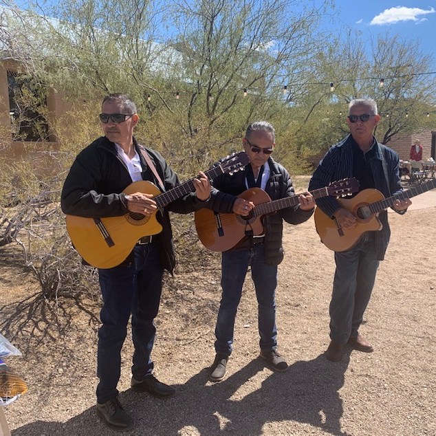
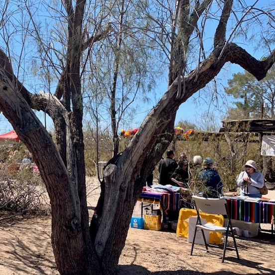
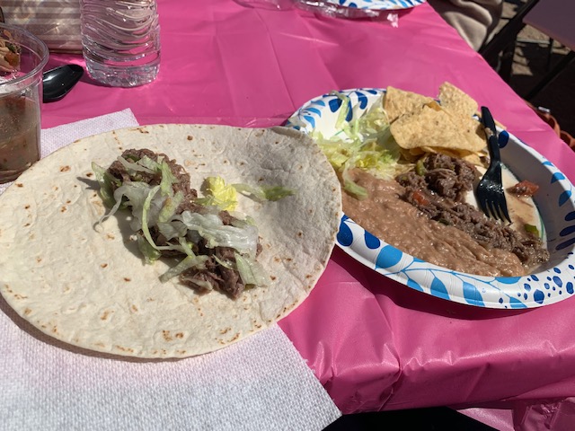
Right next to the Chapel they had music playing, people dancing and partaking in delicious Mexican food.
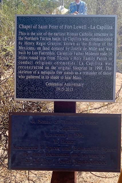
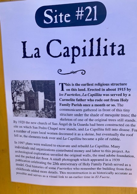
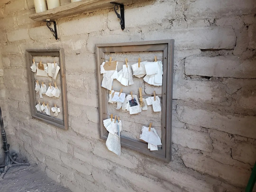
It is called La Capillita, which means little chapel. This small sanctuary is a reconstruction of the earliest religious structure on this site. First erected in about 1915, La Capillita was served by a Carmelite father who rode out from Holy Family Parish in Tucson for the services. The community gathered in front of this tiny structure under the shade of mesquite trees while the priest stood inside. In 1997, an archeological exploration revealed the original walls, the mud adobe foundation, and the packed dirt floor of the original sanctuary. The sanctuary was restored with historical accuracy.
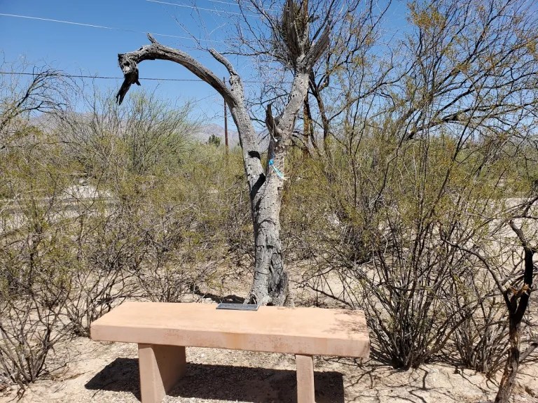
And outside La Chapillita is a bench with a dead mesquite tree trunk behind it. The story is that the mesquite tree was left in place as a reminder of the original El Fuerte families who stood outside the chapel under a mesquite tree for Sunday Mass.
It was great to see Ft. Lowell but the Neighborhood is what was truly amazing!
Welcome to Old Fort Lowell Neighborhood Association, Inc. (OFLNA) web site. We are neighbors dedicated to preserving the history and unique character of our Tucson neighborhood … from Hohokam farmers of 1,700 years ago, to the Cavalry of the 1800s, to El Fuerte’s families, to the present day.
The Alterations people made of the existing building through out the Neighborhood were incredible, as they made simple adobes and such into incredible Mansions!
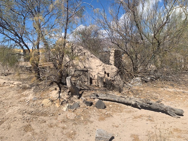
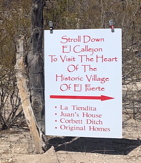
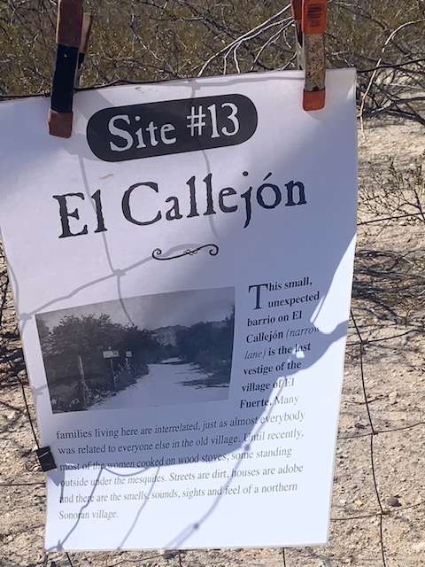
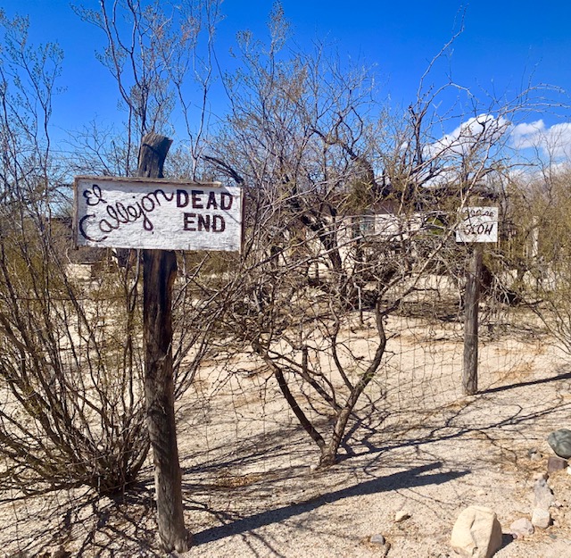
El Callejón is a narrow dirt road in the heart of the Old Fort Lowell neighborhood and historic district. This narrow lane was part of the post Fort “El Fuerte” village that was established in the 1890s and continued through the 1940s. El Callejón was originally settled as a ranchería—a small, rural community of dispersed, often widely separated friends and families living in homes, kind of a small knit family, characteristic of northern Sonora and southern Arizona. The residents here lived a lifestyle closely connected to the land and its resources. It holds significant cultural, environmental, and ecological history, intertwined with the region’s heritage and the families who called this place home in the 20th century.
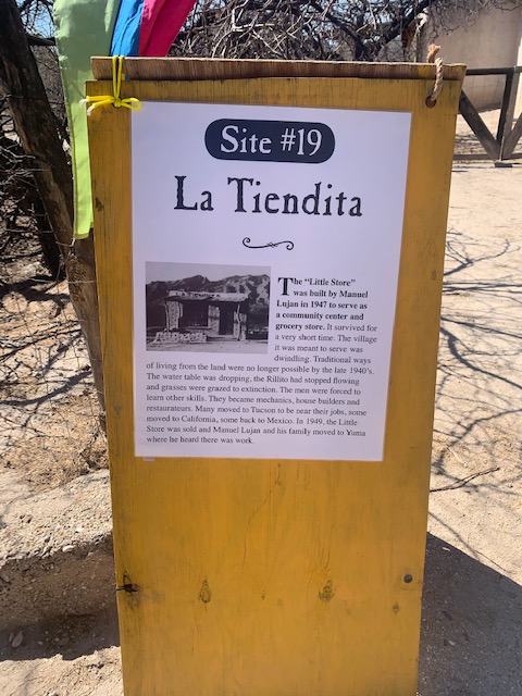
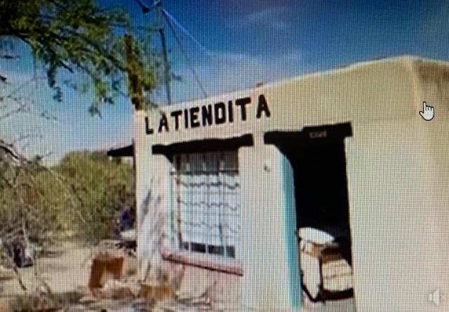
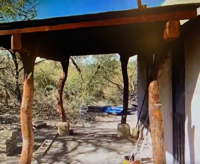
La Tiendita, or “Little Store,” was built out of sun-dried adobe bricks by Manuel Lujan and his brother Juan in 1947. It was intended to serve as a community center and grocery store for the El Fuerte community, The store unfortunately was only in business for a short time. It was due to the decline of the El Fuerte community due to environmental challenges. Manuel Lujan and his family eventually moved to Yuma in search of work marking La Tiendita’s end. The building at one time served as a studio for industrial designer and artist Giorgio Belloli.
At one time the owners repainted the sign. The newer owner’s rebuilt the store making and using adobe bricks. You couldn’t go back in the area but it suppose to be a very nice home with all the hard work they did.
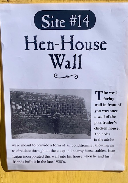
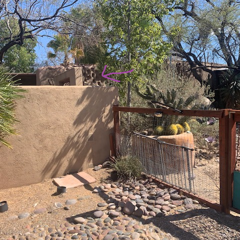
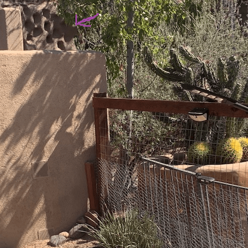
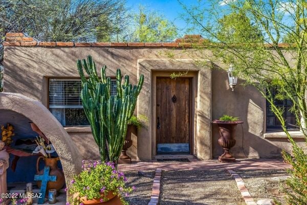
One of the Mansions. Known as “The Hen-House Wall” a designated historic piece of Tucson history located in Fort Lowell Historic Neighborhood. The house was built in 1873 and the holes in the wall provided ventilation for the hen house that supplied Ft. Lowell and the neighborhood with chickens and eggs. Abandoned in 1891 the mud adobe was rebuilt in the late 1930’s. A major renovation in the 1990’s joined the henhouse with its sutler’s cottage to create an updated modern retreat and the henhouse wall became incorporated into the house to reuse the historic structures. The house remains a cherished memorial to their legacy, owned and inhabited by their descendants.
The path we were taking was in back of some the historic houses by the fort, including The Hen House. We were looking at the back yard from the fence in the last picture, which was very nice. I found out the the house was for sale in 2022 and I saw some beautiful pictures of what I call a mansion. The house is huge and beautiful and of course it comes with a built in pool.
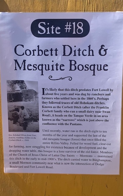
The Corbett Irrigation Ditch, dating back to the 1860s, served as a lifeline for agricultural activities in the area. Fed by gravity from the Tanque Verde area, the ditch supported a thriving mesquite bosque, a remnant of the old Fort Lowell Mesquite Bosque. However, urban development and water scarcity have threatened the existence of both the ditch and the bosque, highlighting the challenges of preserving historical landscapes in a rapidly changing environment. The community is helping to save the ditch, one of the things they are doing is removing an invasive plant that is taking over the area.
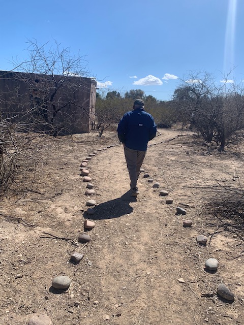
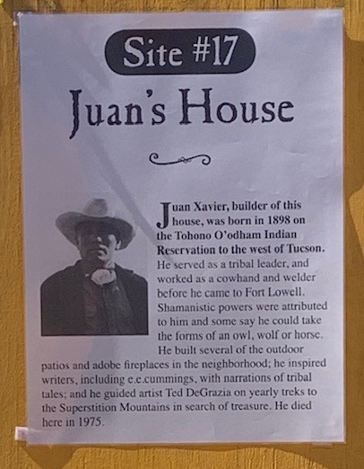
Dave continuing to walk on the path we’ve been taking to the Juan’s House.
Built in 1956 by Juan Xavier, a tribal leader and former cowhand and welder, the Juan Xavier House stands as a testament to indigenous heritage and cultural exchange. Xavier, born on the Tohono O’odham Indian Reservation, was known for his storytelling and his contributions to the neighborhood, including the construction of outdoor patios and adobe fireplaces.
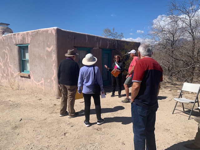
We were following a lady who said there was houses further down a different path, but unfortunately they weren’t open to the public today.
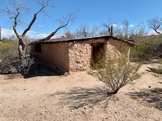
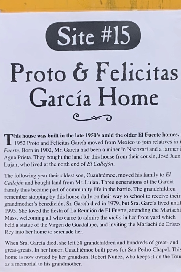
Another Mansion, Built in1952 the house was owned by Proto and Felicitas García and later their son Cuauhtémoc, a skilled carpenter and miner, contributed to the restoration in the neighborhood. His craftsmanship and dedication to preserving heritage were evident in the construction of a beautiful capillain in front of his house, honoring his wife and mother.
Unfortunately the Mansion wasn’t open to visit. We continued to follow the path to the next stop.
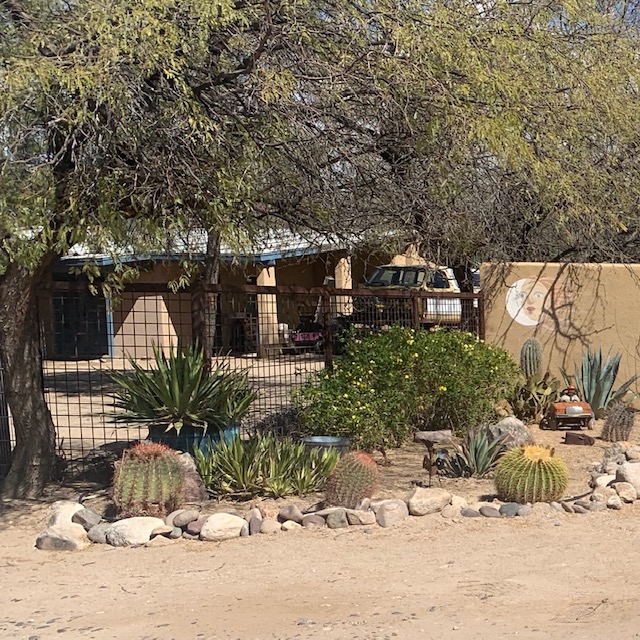
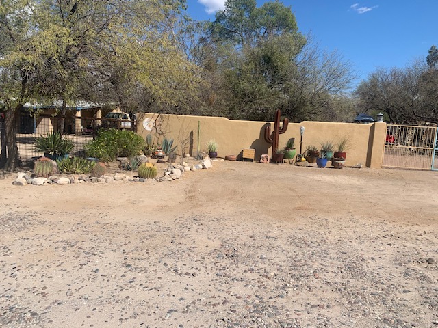
It was originally built as the Fort Lowell Post Traders Store in 1870 from un stabilized mud adobe in a territorial style. After the closure and decommissioning of the Fort, the property had successive owners and uses including a farm headquarters and tuberculous sanatorium. In 1976 it was individually listed in the National Register of Historic Places.
This Mansion we got to see inside!
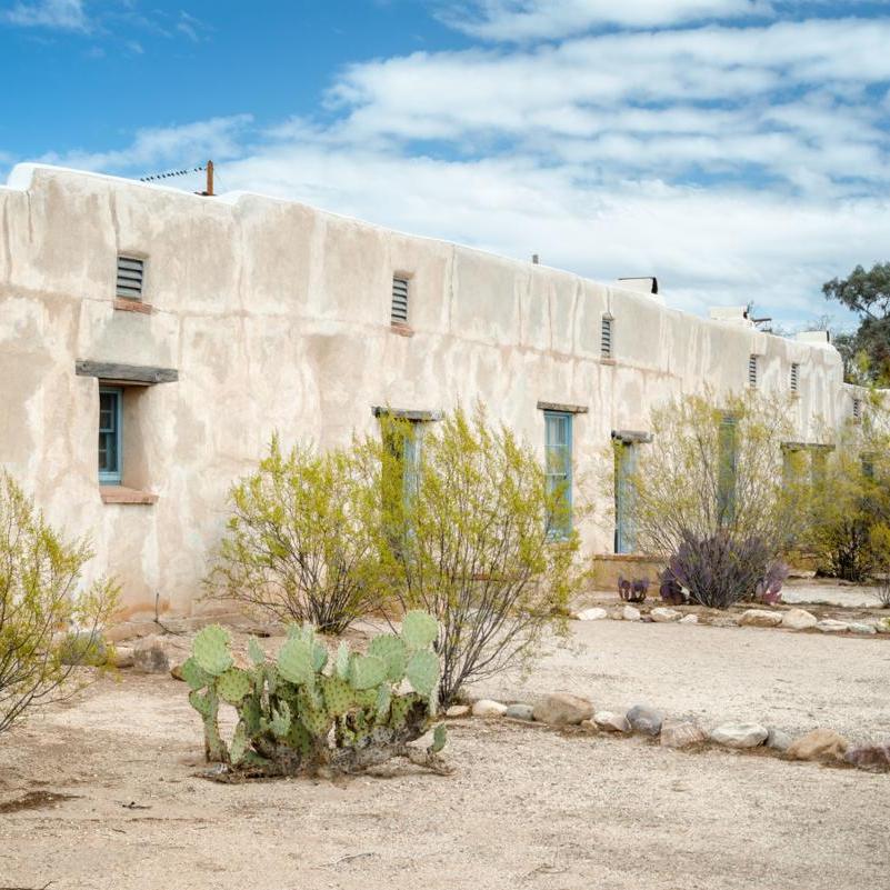
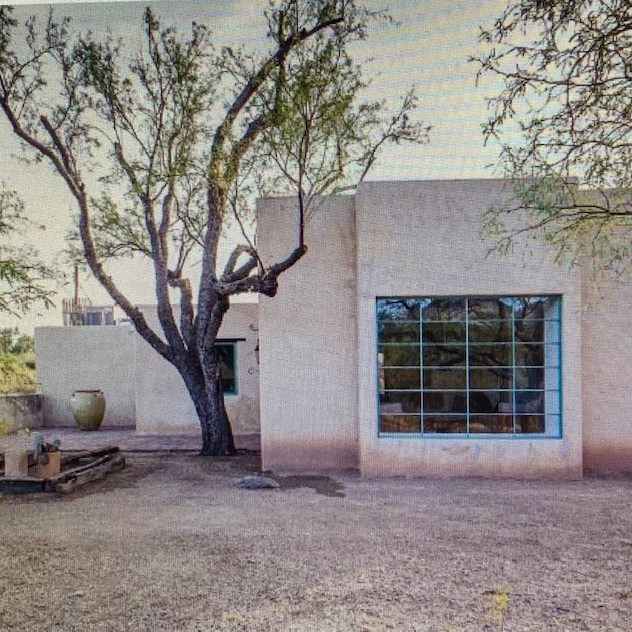
It was gorgeous! In 1873 John B. “Pie” Allen built a trading post near Fort Lowell. 19-room structure contained storeroom, a bar, gaming rooms for officers and enlisted men, and living quarters. The post trader provided necessary and welcome diversions for the soldiers. After several uses the ranch fell to ruins. The property was purchased by the Bolsius Family in 1934. In 1974 and again in 2022 the house had major alterations and in 2023 the house was purchased again from people from New York. They were kind enough to let people see their beautiful mansion. Dave was talking to the owners and joking asked where the pool was, the owners then pointed to where the in ground pool was, no joke.
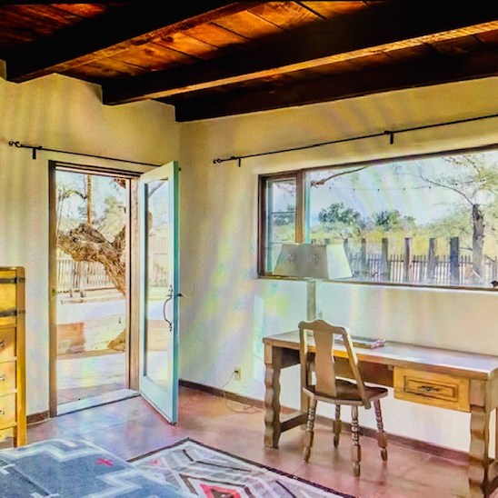
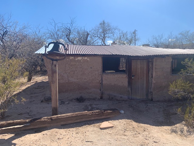
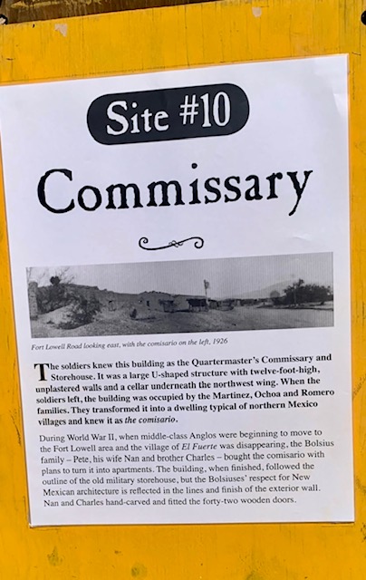
1934 – 1960s: Dutch brothers Charles & Pete Bolsius, and Pete’s wifeNan Bolsius, spotted the ruins of the Post Trader’s Store at 5325 East Fort Lowell on a trip to Tucson from Santa Fe. They bought and restored it, with Nan & Charles hand carving doors and beams and sculpting . Later they bought the adjacent Quartermaster’s Commissary, restoring it in the same way. Charles was a painter, having studied at the Hague; Pete’s primary role was to earn the money which supported all three during the restorations, but he also worked with tin, making candelabras, frames and lamps.
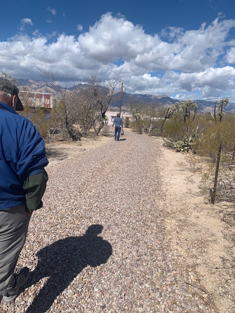
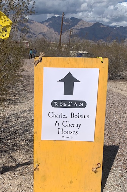
Following the path to Site 23 and 24.
House – Before, The Bolsius home, formerly the sutter’s store, built in 1870, at the Ft. Lowell.
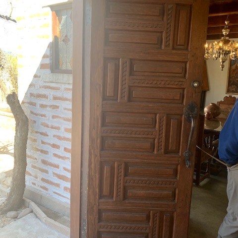
We went into this Mansion too! Check out the carved doors by Charles Bolsius
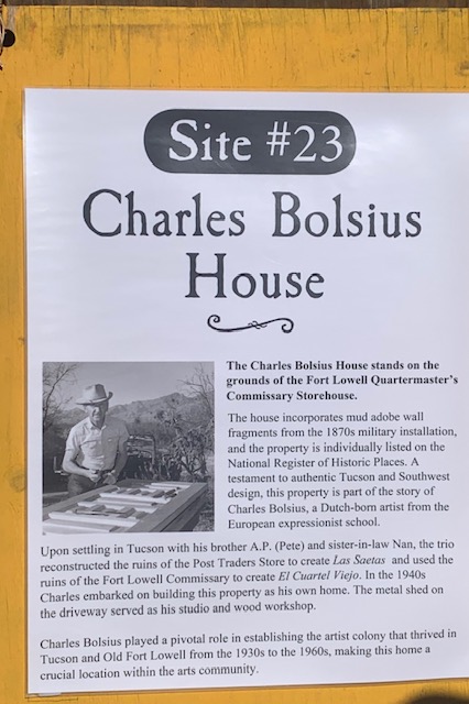
The Charles Bolsius House was originally a small adobe storehouse-workshop located on the property of the Fort Lowell Quartermaster and Commissary Storehouse. The house was designated a contributing property to the Fort Lowell Historic District and in 1978 it was individually listed in the National Register of Historic Places.
In 1942, the Quartermaster and Commissary Storehouse Property was sold to members of the Bolsius family for $10.00. Many alterations were made through out the years.
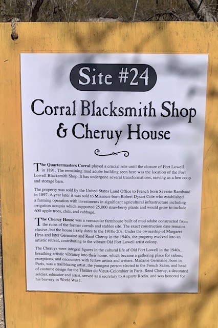
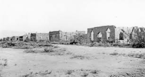
Cheruy house before renovations. It’s now listed on the National Register of Historic Places in 1978.
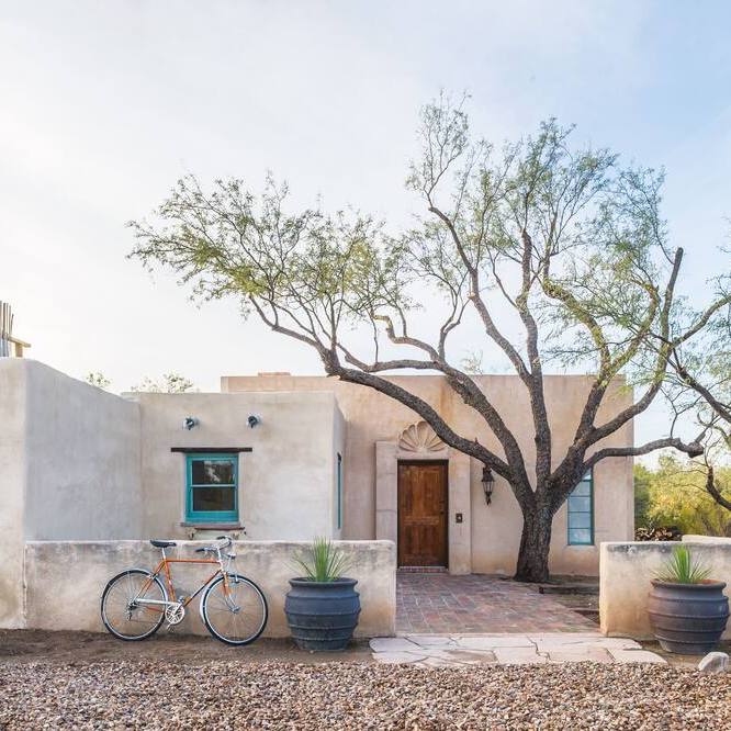
Built in the 1870s, this storied adobe has lived many lives—first as a U.S. Cavalry fort stable, then a humble farmhouse, and later, an artist’s sanctuary of famous French artists Rene and Madame Germaine and Rouget Cheruy. Being restored the Casa Cheruy is a place of history and grace with Southwestern charm blended in.
This beautiful mansion is now an AirBnb for only $785 a night with a minimum stay of two nights. What are you waiting for, it’s a steal. 😄
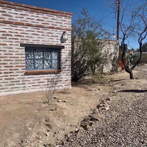
On the property sits this building that was once the blacksmith shop for the fort and at one time was likely used as a barn or hen coop in in the early 1900’s
EARLY ARTISTS & CRAFTSMEN OF THE OLD FORT LOWELL NEIGHBORHOOD
There was a community of famous artist’s in the ft. Lowell Neighborhood, It was called the Old Fort Artist’s Colony. Starting in 1934, Nan, Pete and european artist Charles Bolsius purchased and reconstructed the adobe ruins of the Fort Lowell Post Traders Store converting the property into their home and studio. Through the 1930’s and 40’s a number other artists moved into Old Fort Lowell creating a artist colony. Notable artists and intellectuals built homes and lived in the crumbing adobe ruins. The artist colony attracted famous writers and poets including beat generation author Alan Harrington and Jack Kerouac whose visit is documented in his iconic book On the Road.
Two artists, René Cheruy and his wife Germaine Rouget who was born in Paris, were famous artists through out Europe and America. In 1924 they moved to America. But In 1939, “carrying two suitcases”, Germaine Cheruy arrived in Tucson, Arizona to spend the winter. She rented a small house and described Tucson as a “wilderness” where “everybody was friendly, you never shut your door. You could go to the movies for hours for 16 cents or the market with a dollar for the whole week’s shopping.”By the late 1940s the couple purchased Casa Cheruy establishing a home and studio. In their home they hosted receptions and and parties for other artist and writers. I thinks it’s very attention grabbing that such famous artists like Germaine Cheruy would hang out in this area in Tucson. But with an artist’s imagination, cleverness and artfulness mixed with the beauty of the surroundings mountains and I begin to see why.
Germaine Rouget Cheruy Paintings.
After the fort was abandoned the commissary building was modified and converted to apartments. As of March 1, 2023. The City of Tucson now owns the property. We talked to a lady who was on the, Old Fort Lowell Neighborhood Association, Inc., she lived in one of the apartments and said they were very nice and she enjoyed living there.
Today, this Historic area and it’s many stories of transformation capture the Tucson style of the American Southwest. From the Hohokam who inhabited the Tucson basin and settled a large village on the property during the Sweetwater phase (circa C.E. 650-700); to the establishment of the US Territorial Fort Lowell from 1873 – 1891; from the construction of a hispanic farming community in the ruins of the fort to the creation of an artist colony in the desert city in the 1930’s. This area symbolizes the cultures and people who called this place home today. Dave and I were thrilled to have this is opportunity to experience authentic Tucson, especially the residents who opened up their area and homes 1 or 2 days a year and show off their beautiful El Fuerte neighborhood, and for us to see i’s rich historical background and the beautiful mountain landscape of Ft. Lowell.
We were so surprised to see that the Fort Lowell Neighborhood with the old adobe building are now beautiful mansions as well as other new beautiful homes that are now in the Neighborhood of old Fort Lowell.
“Mystery, deep and shadowy broods over the desert. By night stars keep an ever tender watch from their sentinel stations in the sky: and by day white clouds, the great birds […] filt across the azure field. ”
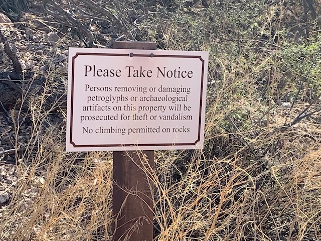
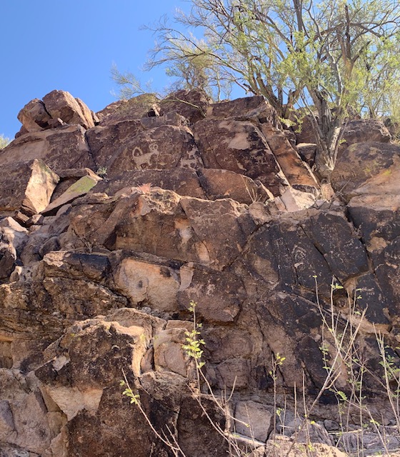
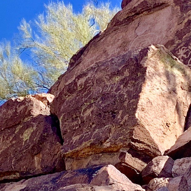
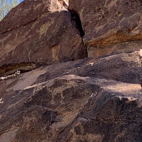
Hike to Picture Rocks Petroglyphs In
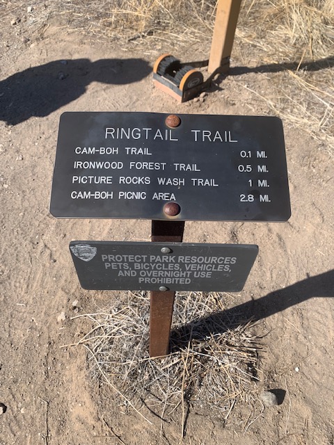
March 10th we hiked to see The Picture Rocks petroglyphs at the foothills of the Tucson Mountains and the Sonoran Desert. We drove to Camino del Cerro where to there is a place to park, and headed out to see the petroglyphs. The petroglyphs is a site with hundreds of petroglyphs from the Hohokam era and before carved into the rocks, we were excited to check them out. We started at the Thunderbird trail which passes through State land and a portion of Saguaro West National Park.
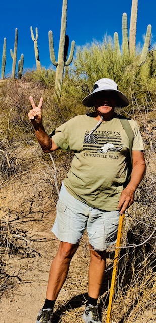
There is a peace sign saguaro behind Dave, who is giving us a peace sign.
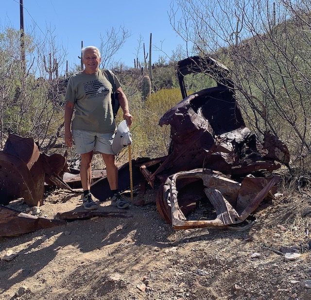
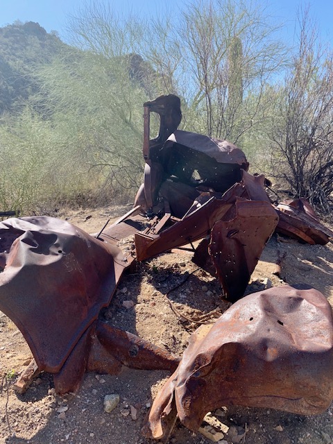
Then we picked up Cactus Canyon Trail and followed it to Coyote Pass Trail, then Picture Rocks Wash Trail. We continued down the wash and stopped at an old rusted out truck.
It was a perfect morning to take a hike with the amazing scenery and a few spring flowers here and there.
Which way do we go? The cactus is pointing to the left and right. He doesn’t know the way to go either.
An old rusted truck on the path.
During World War II, General George Patton used this area as headquarters for tank training. Eventually the railroad and the highways — first U.S. 80 and then Interstate 8 — would parallel the trail that was blazed so very long ago.
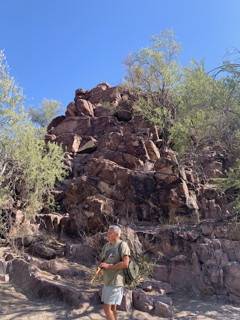
A few more steps and we were there.
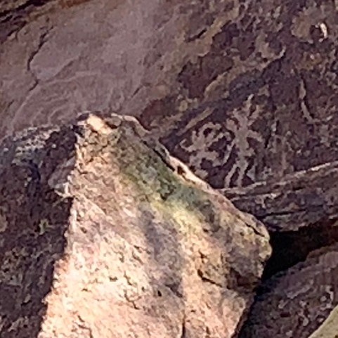
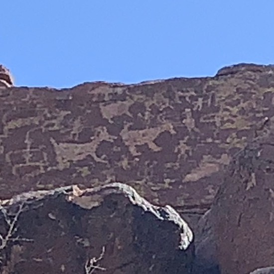
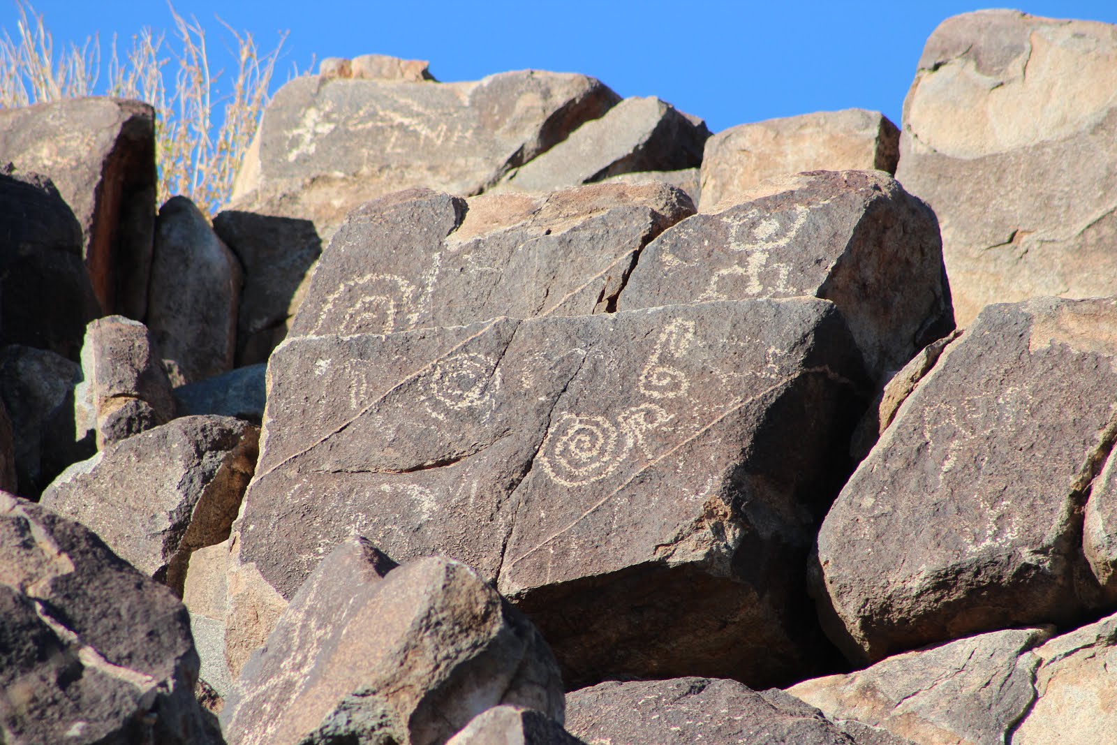
It was awesome to see hundreds of petroglyphs carved into rocks right next to you.
The site’s glyphs are of a variety of designs, depicting anthropomorphs (human-like figures, but archaeologists are unsure if they depict humans, deities, or something else), animals, and designs such as spirals. Archaeologists are unsure of the meanings of most of the petroglyphs, however, one of the spiral glyphs on the west face of the rock formation interacts with the sunlight in a way that indicates its use as a calendar. During each fall equinox and summer solstice, the light interacts with the glyph to form a “light dagger” through the center of the spiral.
Petroglyphs are pictures that told a story, showed an account of events, were instructional tools, calendars, maps, astronomical charts, etc. They were a part of early communication, and I’m sure some were just someone showing off, like today’s graffiti.
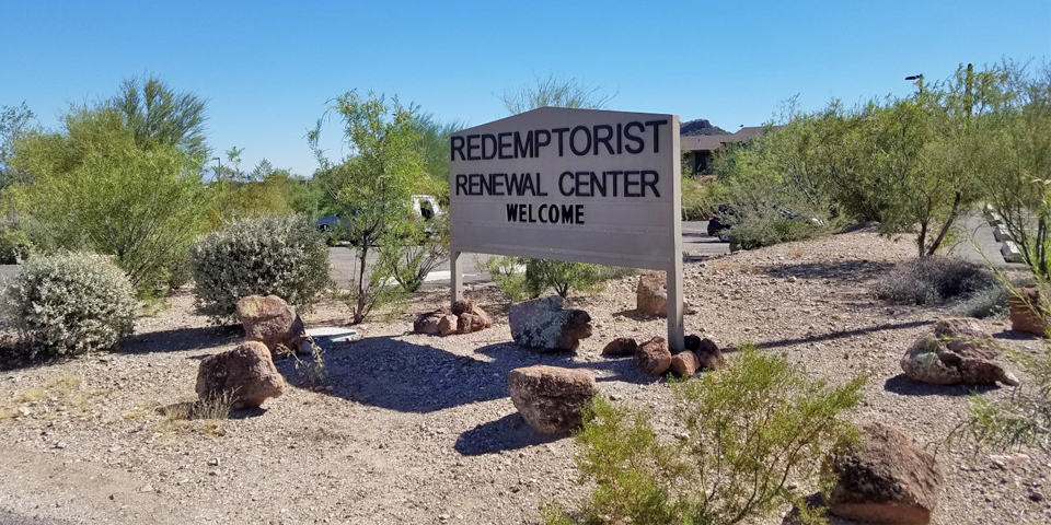
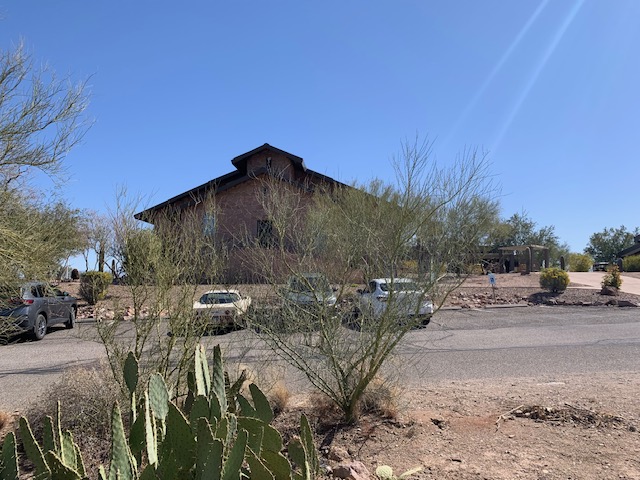
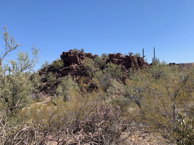
The Picture Rocks petroglyphs are on the property of the Redemptorist Renewal Retreat, so we had to check it out while we were there.
“For visitors who take precious time away from their demanding life circumstances, the Renewal Center becomes what it once was for the Hohokam, who etched their appreciation of life and its meaning on the jagged rocks hundreds of years ago it’s now called holy ground.”
It’s in a beautiful location, in the foothills of the Tucson Mountains and the gorgeous Sonoran Desert. A place that provides a unique opportunity for solitude, reflection, prayer and contemplating life. I know I wouldn’t mind staying there for a week or even two, too be able to renew and repair, what about you?
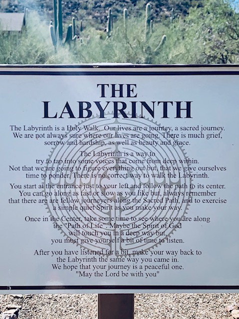
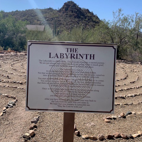
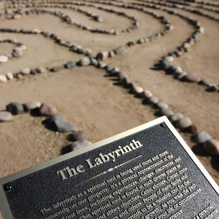
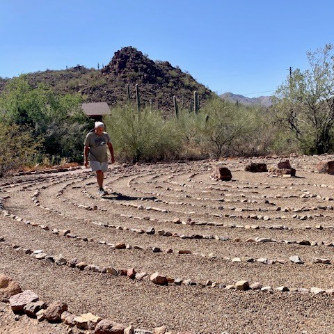
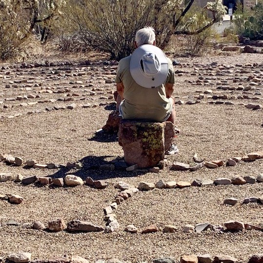
One of the things they have is a Labyrinth. We’ve walked these before but this one was amaze not just a round circle. So we both walked the path in and out.
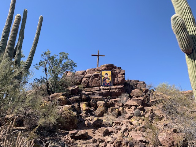
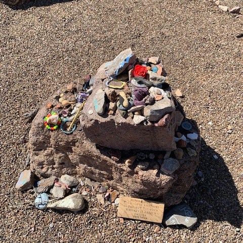
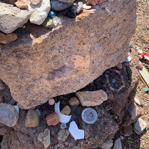
People leave personal items at the rock, I believe as a spiritual connection to express grief or remembrance, a simple offering of their faith.
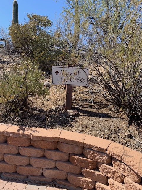
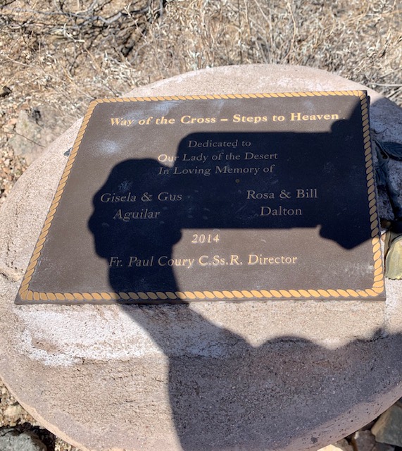
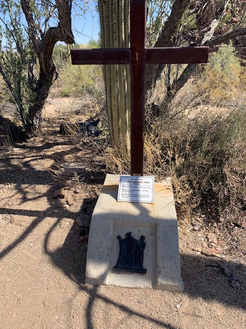
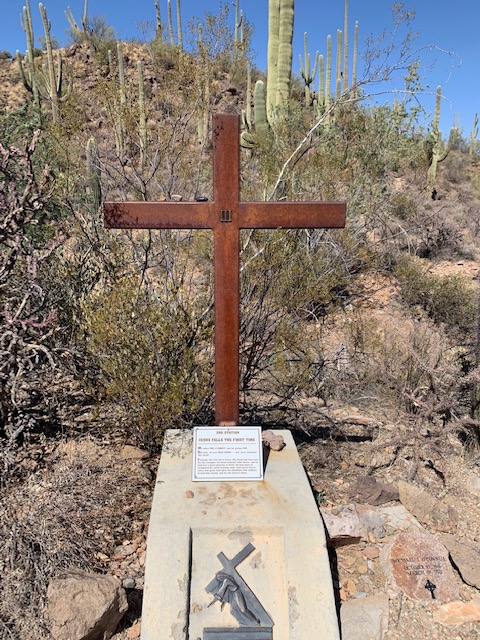
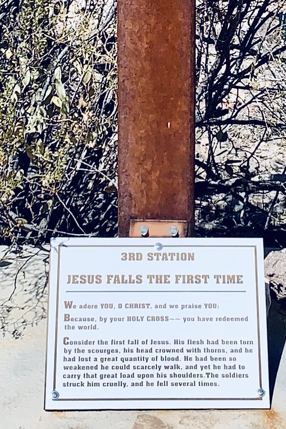
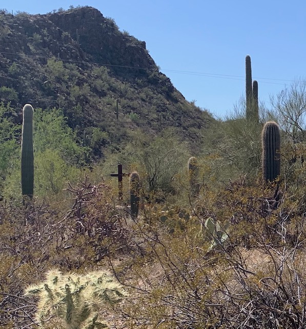
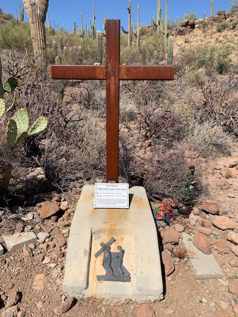
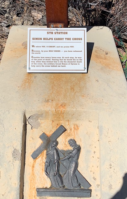
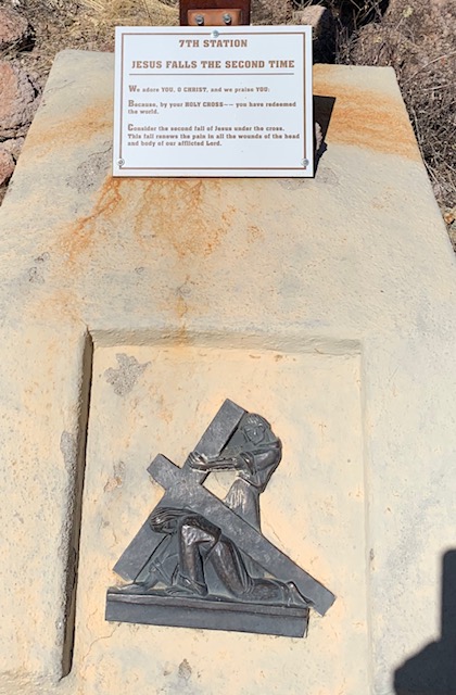
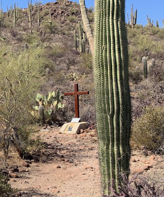
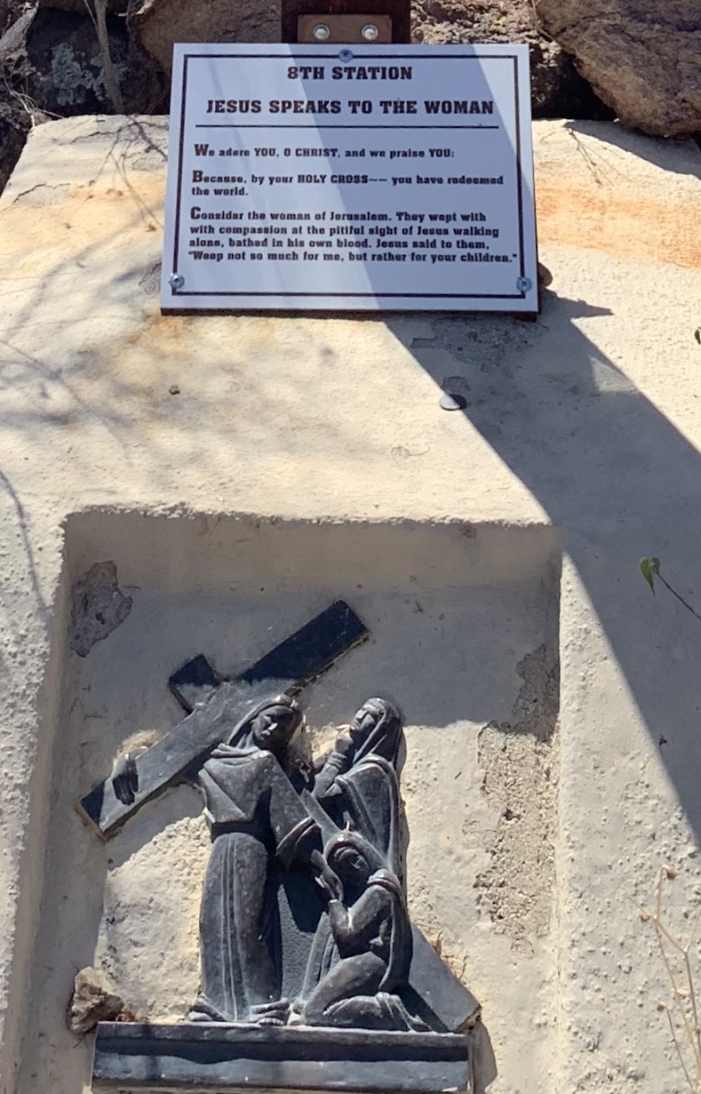
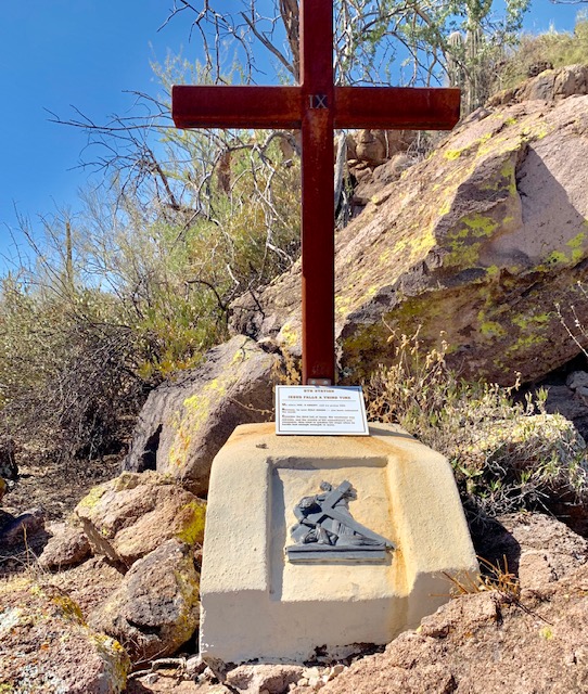
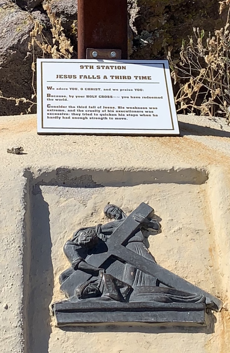
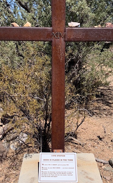
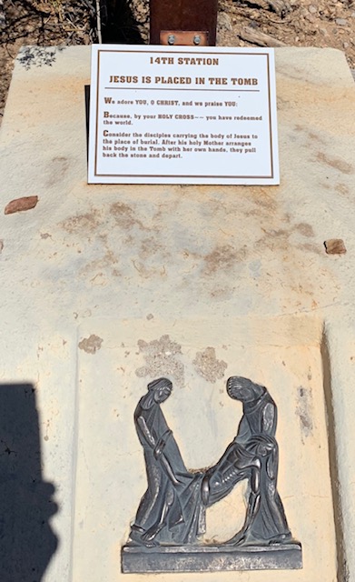
We followed the Stations of the Cross, it’s a way to commemorate Jesus’s passion and death on the cross. There are 14 stations that stations, I thought you might like to see a few of them.
1st Station of the Cross
3rd Station of the Cross
5th Station of the Cross
7th Station of the Cross
8th Station of the Cross
9th Station of the Cross
We’ve reached the 14th station of the cross, “Jesus is Laid in the Tomb,” this marks the end of the Jesus’s suffering and symbolizes the burial of Jesus, a time of sorrow and hope before his resurrection.
The hike we took to the petroglyphs and to the Renewal Redemption Center was spiritual. I think it’s exciting to see remnants of a far gone era. Plus walking the Labyrinth and the stations of the cross you felt a connection between the new and the old existences.
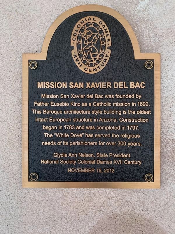
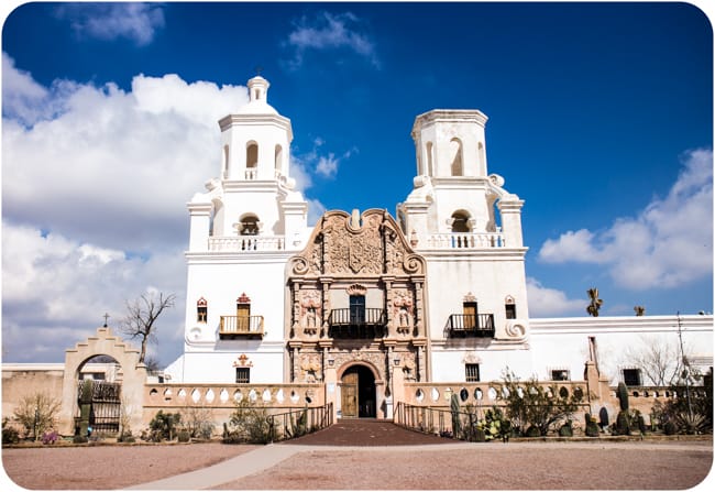
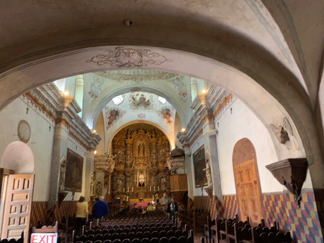
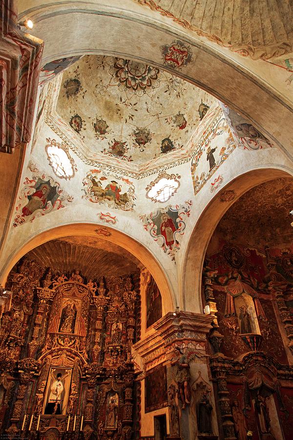
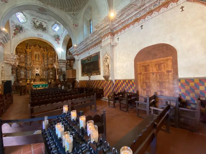
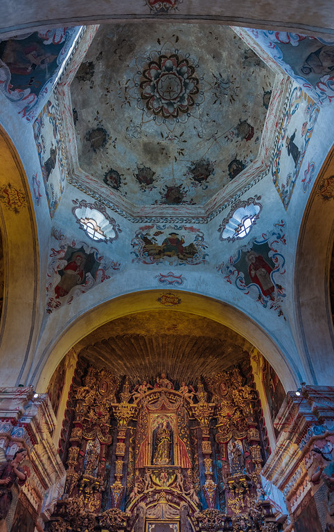
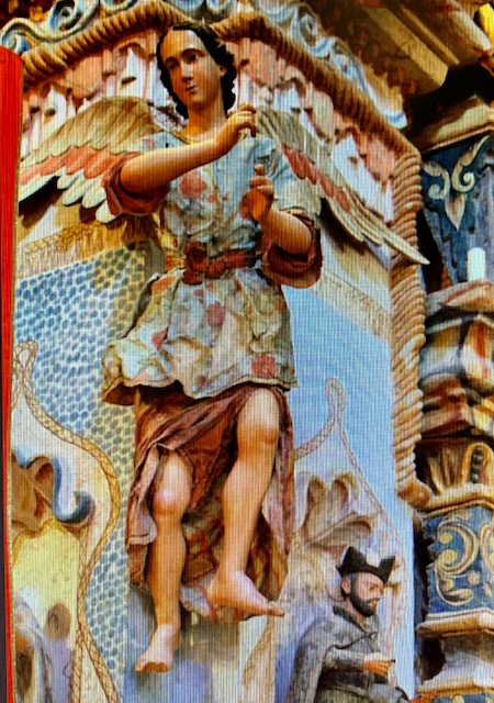
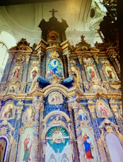
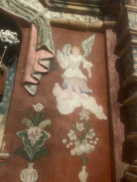
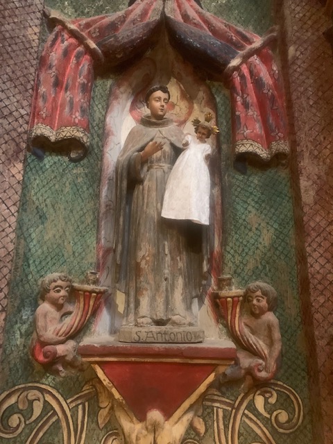
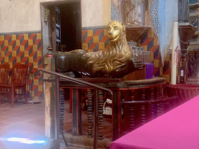
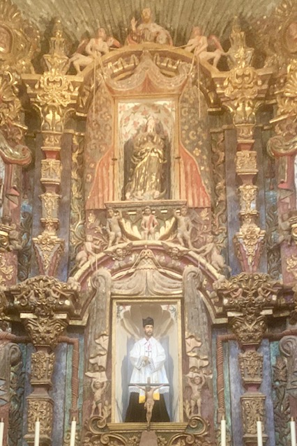
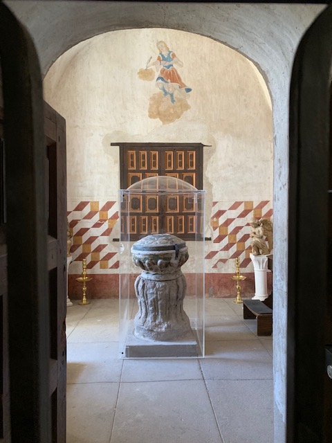
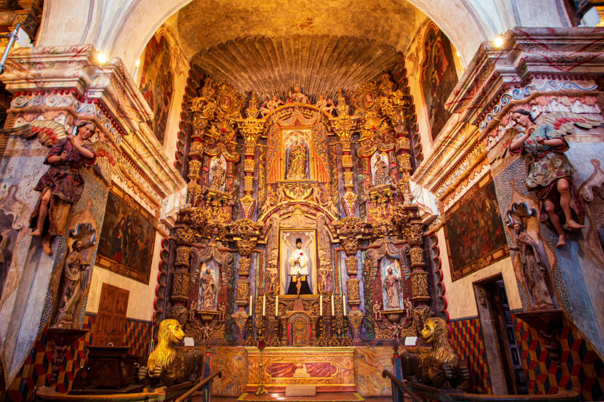
Mission San Xavier del Bac, The White Dove of the Desert.
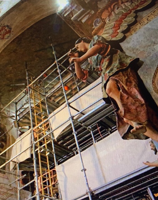
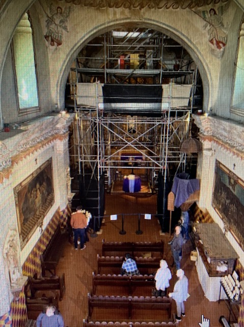
The first time we came to see San Xavier del Bac Mission was with our friends Scott & Dawna in March of 2023. We didn’t get to see the alter due to the refurbishing being done.
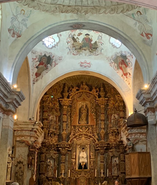
There were four main artists that painted the artwork inside the church, with the assistance of many Pima Indians who filled in the colors with native available stains from plants and animals. Almost every available space inside the mission has a painting or sculpture. The paintings have the look of the Folk and Baroque style art of 1700’s religious figures.
The alter was once again has been painstakingly restored using only original materials found in the desert, basically they hand painted bricks on the wall using plant dies, not an easy job. The amount of artwork on the walls and ceiling is completely overwhelming considering it was done over 220 years ago by Indians climbing up over 50 feet to the ceilings on log ladders that were tied together with leather straps.
We did go back on March 18th to see the alter area finished.
It is for sure an elaborate, multi-colored, decorated alter. When it all really hits you, it is nothing short of breathtaking.
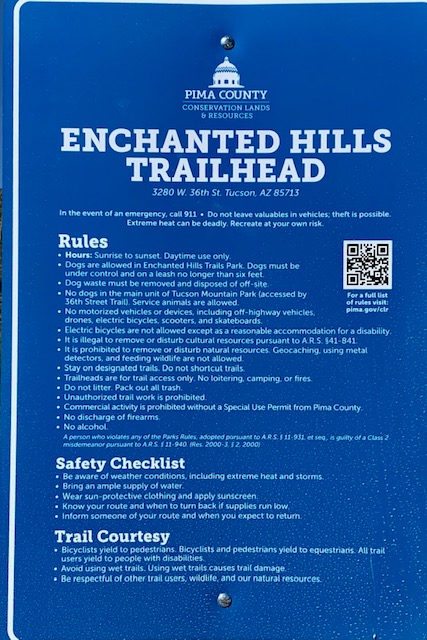
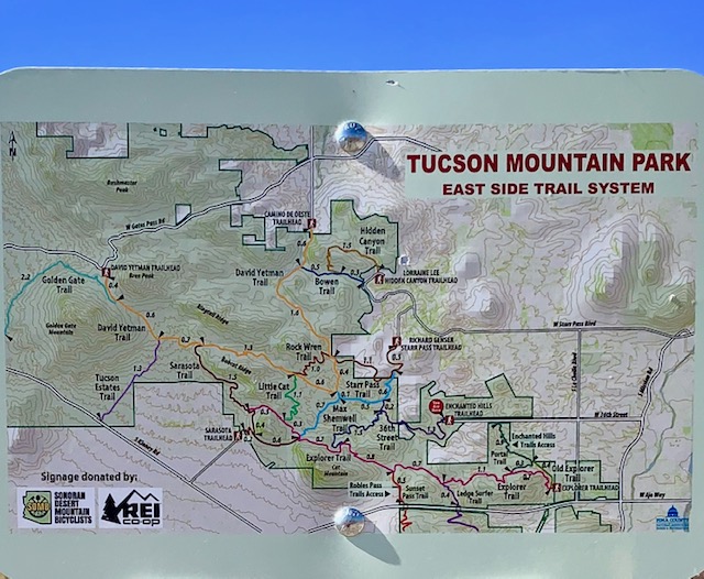
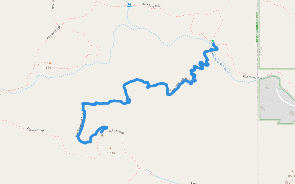
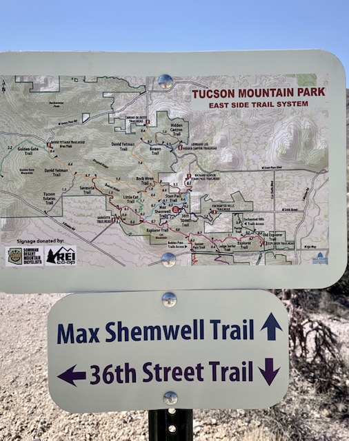
Located at the western end of 36th Street this trailhead takes you to the Tucson Mountain Park and Enchanted Hills Trails Park.
We took the 36th Street trail to the Max Shemell Trail and back.
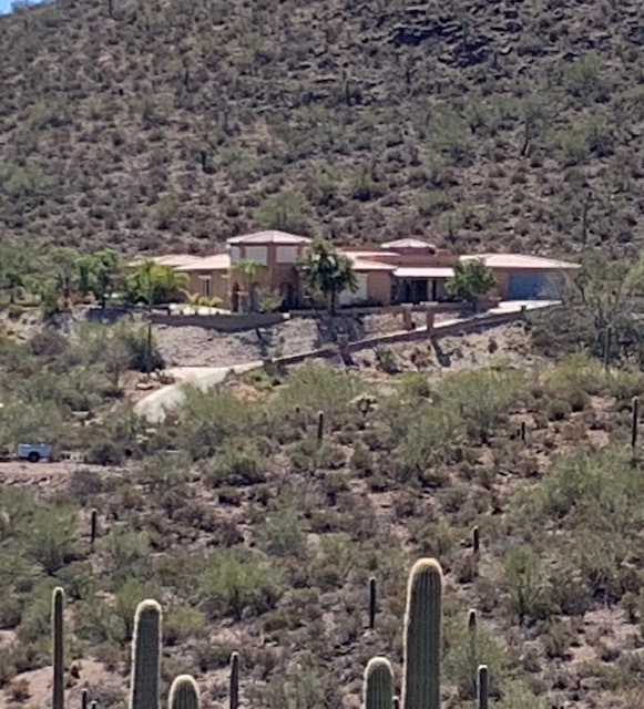
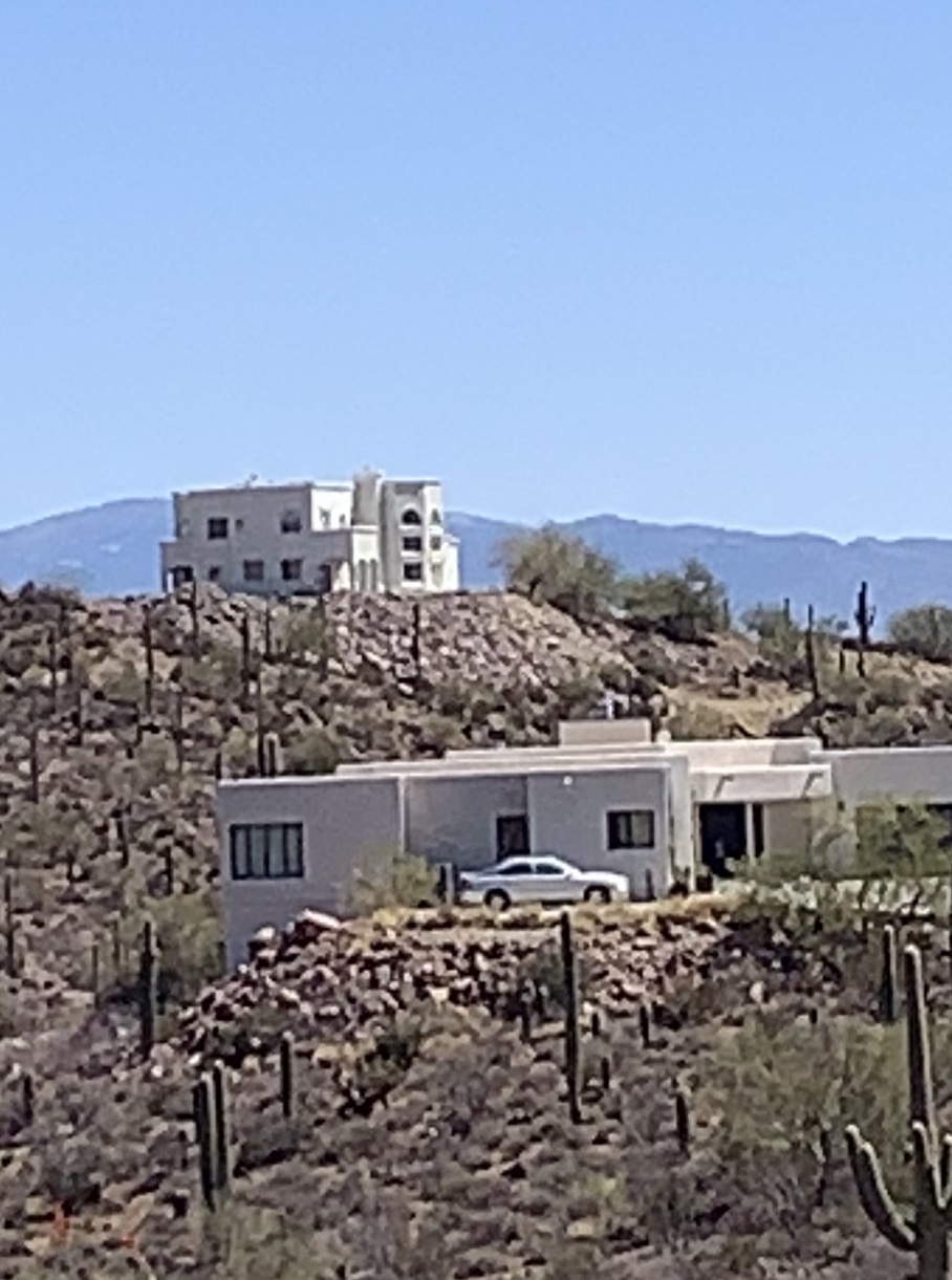
Walking on the trail on the other side of the wash were these mansions with beautiful views. On the down side, if there is one, they have to have their own roads to get to their driveways.
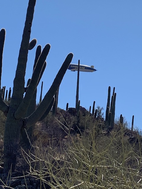
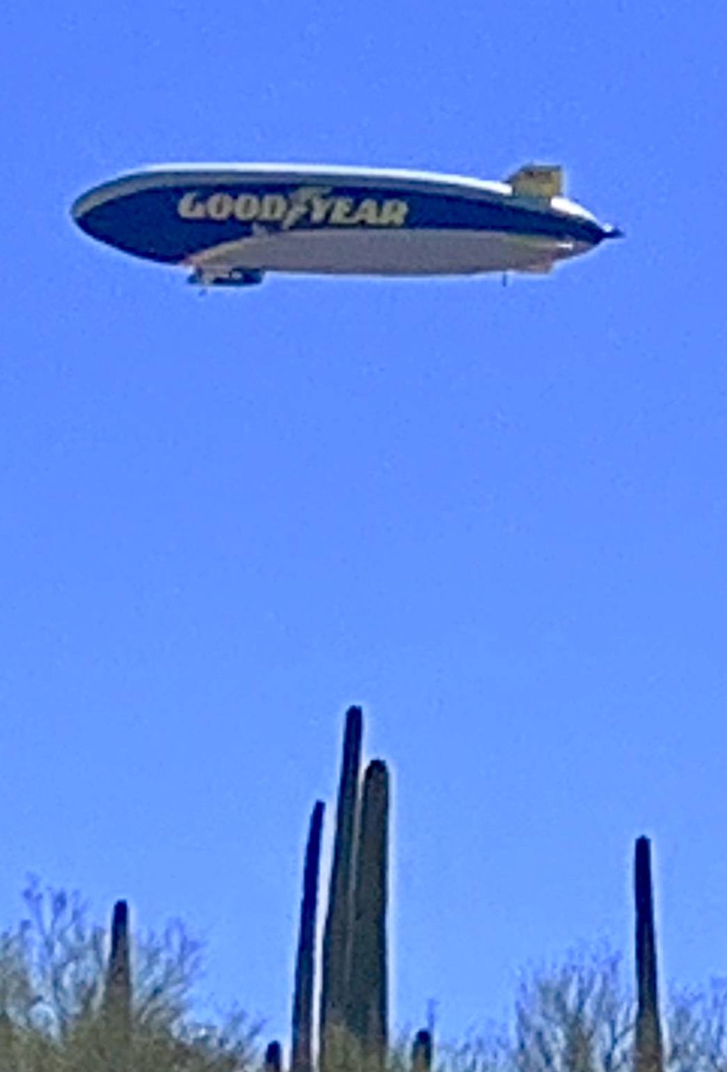
Walking on the trail above us. . . . . was it a bird, a plane, no it wasn’t superman, it was the Goodyear Blimp! up close and personal, We were both shocked to see it.
We stopped at the Max Shemwell Trail and headed back the way we came.
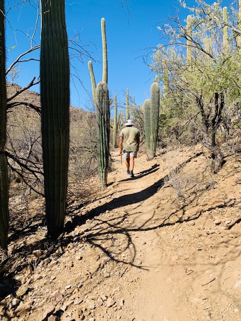
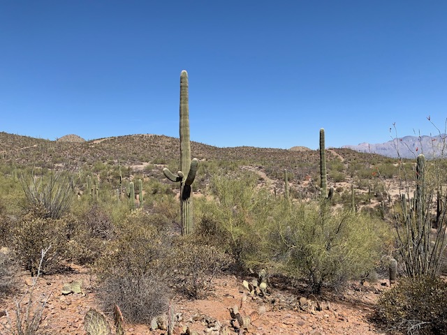
Another great day for a hike in the mountains of Tucson.
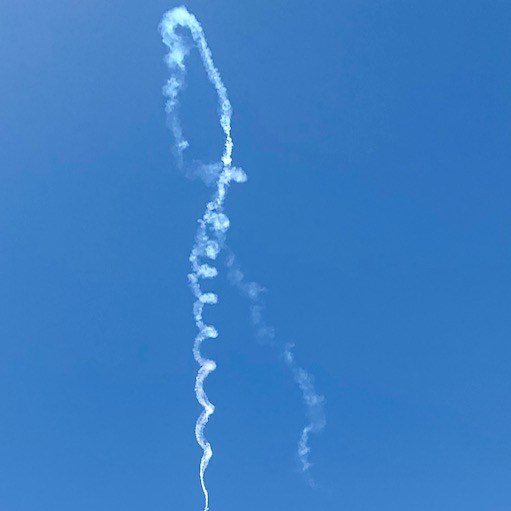
The Thunder & Lightning Over Arizona Air Show was Held at Davis-Monthan Air Force Base in Central Tucson On the weekend of March 22-23, 2025
Dave, Me and Alicia went to see the Thunder and Lighting Over Arizona Air Show.
Celebrating the power and precision of military aviation, with thrilling aerial demonstrations.
Davis-Monthan Air Force Base in Tucson is known for its air support missions and ground attack units.
Opening Ceremonies
Let the 2025 Thunder & Lightning Over Arizona Air Show begin: Featured performances by:
AFA Wings of Blue
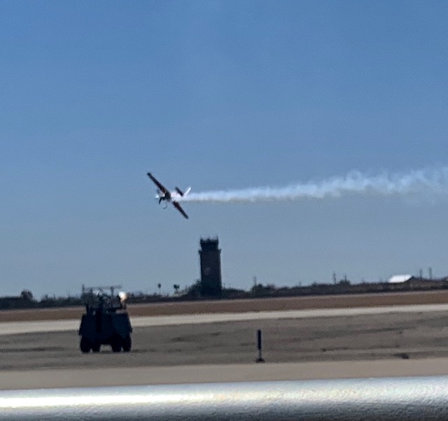
Kirby Chambliss Edge 540 Teaser
HC-130J Combat King Flyby
Brad Wursten MX-2
Jon Melby S-1-11B
Smoke N’ Thunder Jet Car
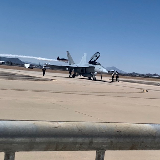
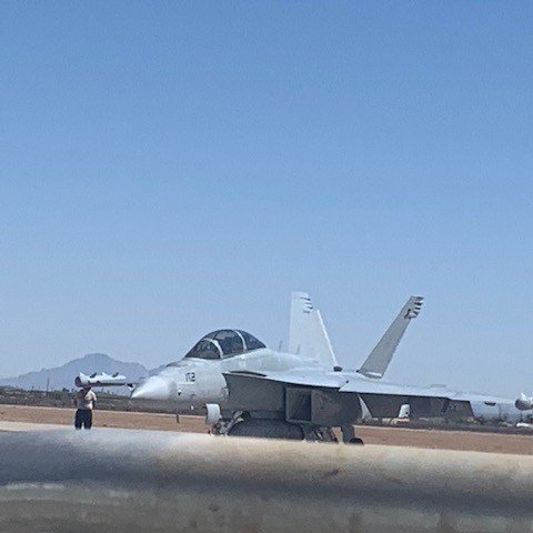
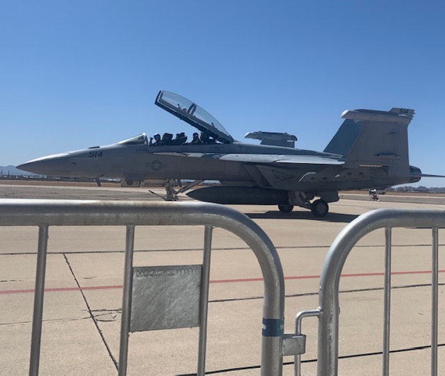
EA-18G Growler Demo Team (2)
Launch CSAR
Tom Larkin MiniJet
DM CSAR Demonstration
Vicky Benzing P-51
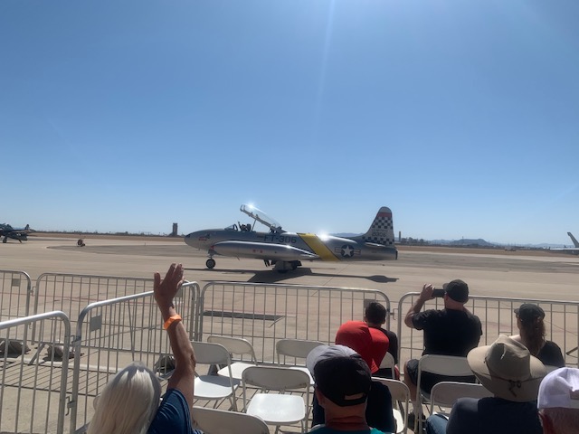
Ace Maker T-33 (2)
F-35A Demo/Heritage Flight
Kirby Chambliss Edge 540
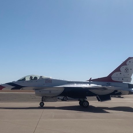
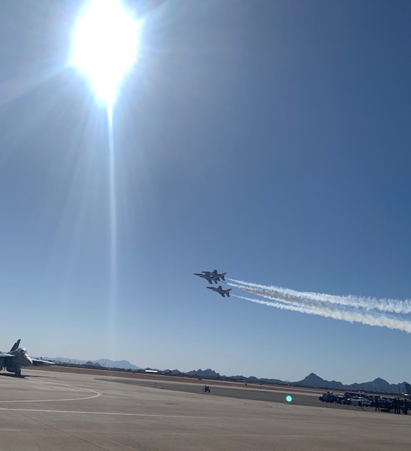
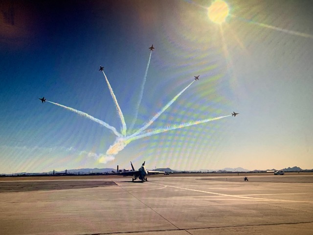
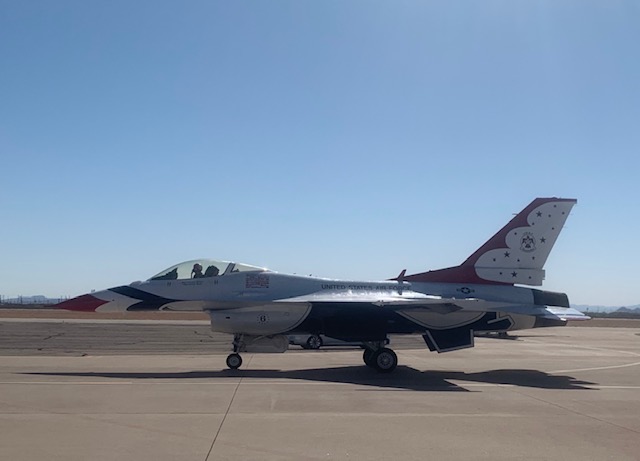
U.S. Air Force Thunderbirds
We had great seats in the front row.
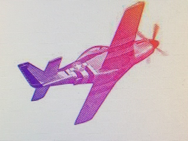
The ‘Purple Mustang’ is an iconic fixture in the warbird community. Among the highlights of the air show is a performance by Vicky Benzing, one of the few female aerobatic pilots in the United States. Showcasing her skills in the iconic purple P-51 Air Racer, “Plum Crazy.” With very few warbirds still flying in the country, Benzing’s performance is a rare spectacle, especially as one of the few flown by a female aerobatic pilot. She was amazing to watch.
They had a car race a plane.
The Thunderbirds perform these incredible demonstrations all over the world and are part of the USAF combat force and if required, can be rapidly integrated into an operational fighter unit.
It was extra neat to be able to wave to the pilots as they were taking off or coming back down.
The three of us all really enjoyed “The Thunder & Lightning Over Arizona Air Show” Being that close you could feel the excitement overload of sound and energy. You felt the ground shake and the roaring blast of the planes and the crowd cheering!