
As I mentioned before, Vicksburg was not on our plans, as a place to stay, but with all the cancellations in Arkansas, due to the virus, this is where we decided to hunker down for a while. I origanaley wasn’t going to post a lot on the battle of Vicksburg, but now after going there 4 different days, and walking over 17 miles of the battlefield, I decided to post a little more in depth on the battle.
Yes, we have been here 4 different days now, the battlefield is closed, no visitor center, no museum and no gate guard. So that means you can park in there lot for free. There are 16 miles of roads in the park, the first time we went there I thought, that the park roads were open, no such luck, they are closed to all vehicular traffic. However you can walk, jog, bike and all that. So that’s what we did the 4 times we were there, we walked about 4 miles a day.
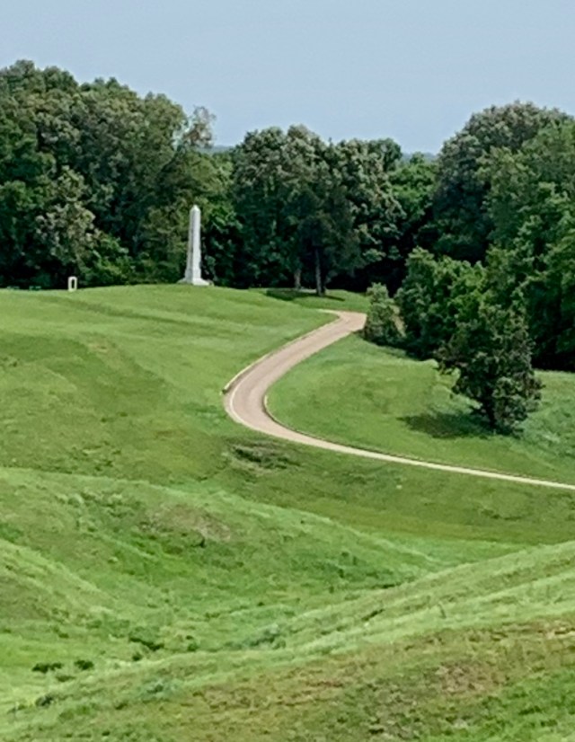
The battlefield has over 1,300 monuments, markers, and tablets, about half each for union and confederate. This is unlike Gettysburg which has over 1,100 but only about a dozen are confederate.
The was a siege more than a battle. The union army had been coming down south on the Mississippi, with union gunboats in the lead taking city after city, but when it got to Vicksburg, the confederate defenses were to strong. So Grant crossed over into Louisiana above Vicksburg marched his way down, crossed the Mississippi at about Port Hudson, below Vicksburg, marched north and east ,and came at Vicksburg by land by the east. By May 18 the battle lines looked like the map below. The confederates were well dug in.
( Red line is the 8 mile long Confederate defenses, surrounding Vicksburg, with the blue as union lines.)
![vicksburg-may-19-22-1863-4[1]](https://roadsofdiscovery.com/wp-content/uploads/2020/04/vicksburg-may-19-22-1863-41.jpg?w=640)
Below,
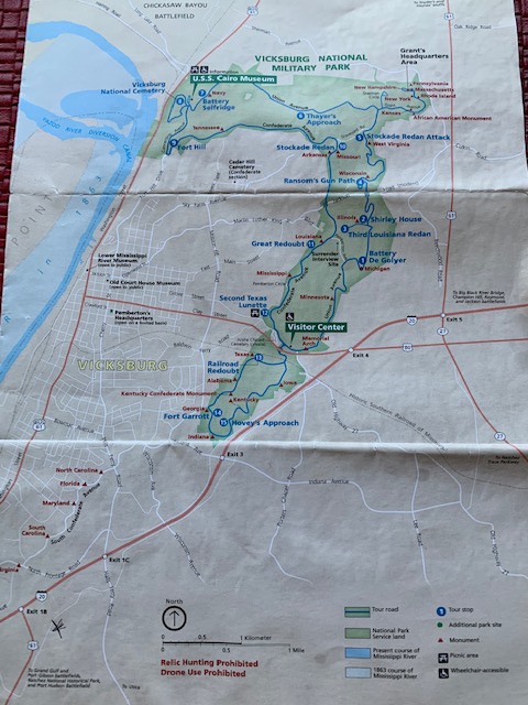
(This map is how it is today with the tour roads in place.)Blue lines are the 16 miles of park roads built by the CCC in the 1930’s, they actually improved the dirt roads originally put in. It is also very hilly here.
Grant, then made 3 separate attacks at the confederate lines, all failed. After that he decided to lay siege to the city and it’s defender’s. For 47 days and nights, he bombarded the city and the confederate lines with over 200 cannons. Out on the Mississippi, above and below Vicksburg, union gunboats bombarded from the river. With the city cut off, soon there was no food, people starting eating, dogs, rats, horses anything they could. They also were running out of ammunition. Vicksburg residents soon were digging tunnels into the ground to live in as the city was pretty much destroyed( Unlike Natchez which has many beautiful 1800 style homes. They just gave up.) With Living conditions horrible and the confederate army starving also, confederate General Pemberton asked General Grant for surrender terms. After there meeting the city was surrendered on July 4 1863. In a telegram to Lincoln, Grant said, I present you this fine fourth of July, “The Key” to the south, the city of Vicksburg. After this the union controlled the Mississippi and closed the door to supplies coming from the west to the confederates. This victory along with the victory at Gettysburg the day before was the doom of the south, although it would take two more years.
As I mentioned Grant made three separate attacks on different days. One of those attacks I would like to describe below. Remember that back then there were virtually no trees at the time, both sides had clear views of each other.
The confederates built a number of strong holds, or large earthen forts, along there lines. They overlooked a large area, within were many cannon, rifle pits bunkers and trenches were men could be covered by enemy fire. These would be manned by a couple thousand troops. One such fort was manned by the third Louisiana, it overlooked an area where the Shirley plantation house was. The union lines were at the Shirley house and on either side of it were large number of union cannon pits. From the Shirley house the union dug trenches towards the Confederate fort, once they got close they started digging a tunnel. They burrowed day and night until they were under the fort. They then placed 2,200 pounds of black powder and lit it. The explosion tour a big hole in the side of the fort, and union troops rushed in, only to be met with a terrific fire from the confederates. More troops poured in until it became hand to hand combat. Back and forth they went, with rifle butts, swords, bayonets flailing for almost 20 hours until finally a fresh unit of confederates came in and plugged the hole. It was a failed attack by the union. After this General grant, decided to lay siege to the city.

Above, shows the union trench lines, dug from the Shirley house and in the middle top the result of the explosion, with union troops moving in.

Above, confederate side of the third Louisiana fort.

A top of the earthen fort, out in the distance is the union line of cannon, and out of the picture to the left, is the Shirley house.

This is the union line looking toward the Shirley house in the distance, the cannon are pointing toward the third Louisiana fort

This is what it looked like at the time of the siege.

I thought this was very interesting. One battery of four cannon, fired 2368 rounds of artillery in the span of less than 10 days.

The Shirley house as it looks today. It is the only surviving civil war house left on the battle field. In the back and to the left are steep drop offs, look at the pics below to see how the union, dug in and lived.

How would you have liked to live like this. The area now is totally tree covered.
![118-Shirley-House-JMM-300x242[1]](https://roadsofdiscovery.com/wp-content/uploads/2020/04/118-shirley-house-jmm-300x2421-1.jpg?w=640)
Another vintage view.
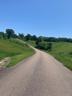
Below are a few of the monuments and terrain of the fields.

I think the Rebs are coming!!!!
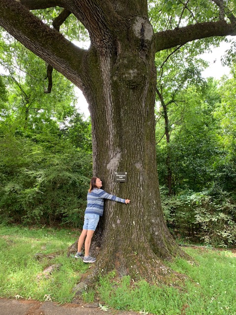
Melissa STOP hugging a tree.


Cooper the mascot

Along the southern part of the battle field, there are few monuments. While there were confederate and union lines there, not a lot happened. So In 1960, that part was turned over to the state and then the federal government, to make way for interstate route 20.

Interstate 20 crossing over the Mississippi into Louisiana

At the very, very southern end there were at the time a 300 acre area that the union had positioned artillery batteries. They were there to stop the confederate from escaping and making there way across the Mississippi. All that is left now is a two acre area, with a few monuments, surrounded by commercial development.

Looks like a beautiful area. That was a great looking tree…no wonder Melissa hugged it